Barrier Maps Updated
30 Apr 2025- Barrier Maps for the UK - Updated
Barrier Maps for the UK - Updated
The Aim
The aim is to be able to produce useful maps for those who are using trikes, wheelchairs, mobility scooters, etc. I don’t possess the skills needed to produce online maps which would show the barriers that may cause problems, but I can produce maps for a Garmin device which show the problems.
Zoom levels
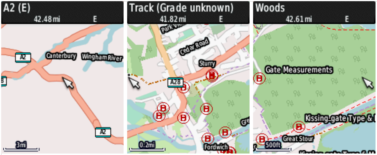
The level of detail now varies according to the zoom level - at the highest level no barriers are shown at all. At medium, they just appear as the red B in its circle. When you are zoomed in, details of what is missing from the barrier are shown.
Barrier Maps for the UK - Updated
access=private or access=customers
If the barrier is marked as access=private or access=customers, or if the barrier has no access tags, but is on a highway which has the tags access=private or access=customers, then that barrier no longer appears in the maps (Although if the highway has a designation such as ‘footpath’, ‘bridleway’ or foot=permissive, then it will still be shown).
highway=steps
Appears if step_count= is missing. This can be easily updated using Street Complete.
barrier=cycle_barrier
Does appear if the measurements are missing, or cycle_barrier= is not shown as either single, double, triple, diagonal or tilted. All is explained, including the measurements needed on the OpenStreetMap Wiki for cycle barriers
barrier=bollard, and barrier=block
Does appear if the measurement of the opening beside the bollard or block is not shown.
Again, can be easily updated using Street Complete.
barrier=kissing_gate
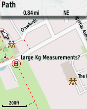 KISSING-GATE-TYPE Appears if the type of kissing gate is missing. LARGE-KG-MEASUREMENTS appears if the kissing_gate is large & the measurements are missing.
If the kissing gate is of the type large_circular_profile, or large_square_profile, it may be wheelchair accessible, and for these two types the measurements are needed for the opening (maxwidth:physical), and the depth of the recess (“recess” is not a common term, and may need altering in the future when it has been agreed / or not, amongst the OpenStreetMap community).
OpenStreetMap Wiki for Kissing Gates.
barrier=gate or barrier=lift_gate or barrier=swing_gate
Does appear if the measurement of the opening is not present - I accept width, maxwidth, maxwidth:physical or opening.
barrier=stile
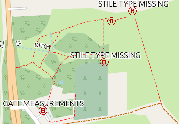
Does appear if the type of stile is missing, or the step_count is missing for stiles with steps.
Most stiles will be inaccessible for wheelchair users, or users with limited mobility, but stile=ramblers_gate may be accessible to some people, and it is conceivable that one with a wide opening is wheelchair accessible.
barrier=horse_stile
Does appear if the type is missing.
Update Schedule
The provisional plan is to update the barriers_filtered map Every Thursday
As with all of the maps, the plain .img file appears first, and should be available to download by 10:00hrs GMT - that’s fairly automated, but the winexe & gmapi files which are provided through torrent downloads requires my input and I’m not always available to do this straight away.
More info
https://wiki.openstreetmap.org/wiki/Main_Page contains all of the information about mapping on OpenStreetMap.
Downloads
If you find this, or any of the maps I create are useful to you, please consider making a small donation to charity at:
https://www.justgiving.com/page/nick-allen-3?utm_medium=FR&utm_source=CL
This is why I’m doing my best to help the charity: https://www.facebook.com/p/Jelly-Beans-Journey-with-Spina-Bifida-61552088571793/
- The barriers filtered Garmin compatible map is available from
https://daphne-nick.uk/nextcloud/index.php/s/WAmCwKGkGigmryn
- but the torrent files needed to download the exe or gmapi files are available from
https://daphne-nick.uk/nextcloud/index.php/s/6cQesAz38DWRWBo.
Viewing the maps on QMapShack
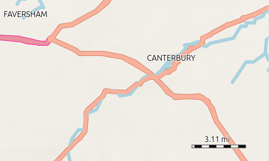 QMapShack at highest level.
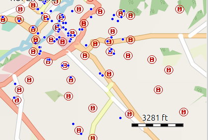 QMapShack at medium level.
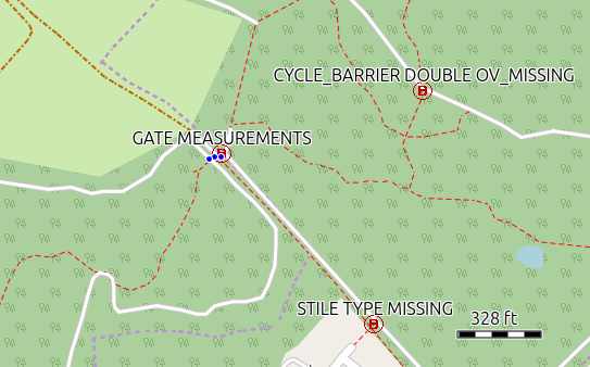 QMapShack at lowest level.
Changes - History
- Originally circulated in 2023 when there were two version, one showing all barriers and any tags/measurements that were present, and the barriers_filtered version which shows only those barriers that require attention.
- 22/06/2025 - Updated the search for Kissing Gates to differentiate the larger versions, which may be wheelchair accessible.
Thinking of making your own Garmin compatible maps?
-
https://github.com/Nick-Tallguy/Tallguy-mkgmap now contains all of the files - feel free to pass comments, suggest alterations, or copy whatever you need.
-
All of the maps are produced using MKGMAP
All data produced by me is subject to the same copyright rules as OpenStreetMap.
” OpenStreetMap® is open data, licensed under the Open Data Commons Open Database License (ODbL) by the OpenStreetMap Foundation (OSMF).
You are free to copy, distribute, transmit and adapt our data, as long as you credit OpenStreetMap and its contributors. If you alter or build upon our data, you may distribute the result only under the same licence. The full legal code explains your rights and responsibilities.
Our documentation is licensed under the Creative Commons Attribution-ShareAlike 2.0 license (CC BY-SA 2.0).”