Combined Garmin Compatible Map
04 Aug 2023Combined Garmin Compatible Map
</! Categories were [OpenStreetMap, Cycling, Walking, Garmin-Maps, Canal] />
No longer being produced - message me if you would like me to resume producing it.
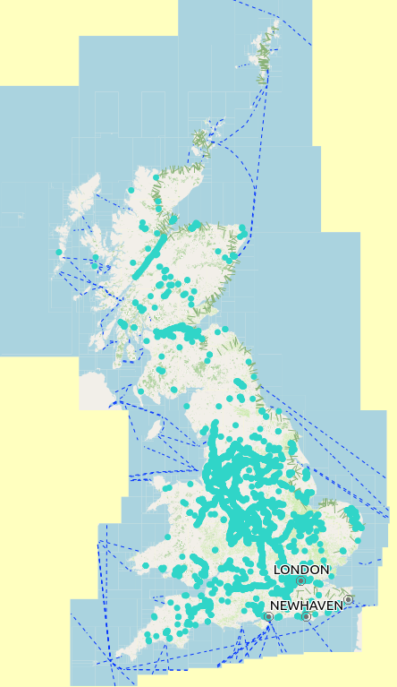
This extends to an area covering most of Great Britain, and within that area shows the routes of;
The Avenue Verte within GB,The North Downs Way walking route,The North Sea Cycle route within GB, andMany canal features, such as locks, bridge numbers & names, winding holes, and water points.
All mapping data is derived from OpenStreetMap, including the downloadable maps. Many thanks to OpenStreetMap contributors for their skill & dedication.
Contact me
If you wish to contact me - feedback about any of these maps is always welcome, please do so through: