North Downs Way, Detling (White Horse Wood Country Park) to Hollingbourne
31 Aug 2020- Route Information
- Background
- Navigation for the day
- The plan for the day
- The Walk along the North Downs Way
- The Pilgrims Way road route back
- Adding information to OpenStreetMap
Route Information
Statistics
Total distance walked: 7 miles or 11.1 km
Total Elevation Gained: 1515 ft or 462 metres
Warnings & possible wheelchair access
Warning: Sections of this route include steps, and stiles - not wheelchair friendly. Some kissing gates are narrow. I will be updating OpenStreetMap so that the areas of steps, and the types of stiles are visible. Most of the ground is uneven but when we walked the paths they were mainly dry and firm underfoot - they look as if they will be very slippery in wet conditions.
Dog access
Dog access There were very few stiles with access for dogs, and you will probably have to help your dog over many of the stiles. I did not notice any ‘dog poo’ bins along the route. Some fields do contain livestock.
Background
The North Downs Way has been a long term project for us, which we first started several years ago. Living fairly close to the route made access relatively easy, and we were also able to use public transport for many of the segments. We’ve reached the stage now where we prefer a hike of about 6 miles, although we can exceed this if needed.
Daphne is in the waiting list for a knee replacement, and difficult terrain can make life painful for her. She’s been told that the exercise that she is doing is good, and to keep it up - paracetamol is always in our first aid kit, and she uses walking poles in areas involving a lot of climbing and descending - just about the whole of the North Downs Way, really!
Navigation for the day
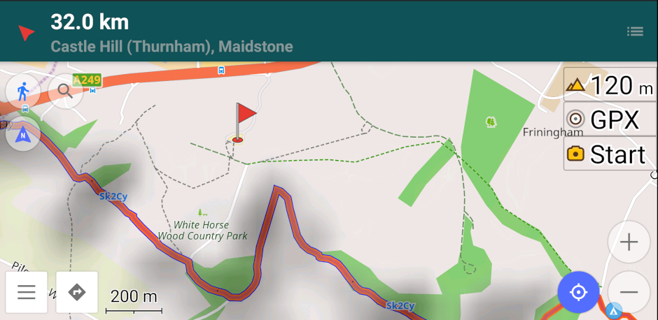
I use Osmand+ on my Android phone, and it makes navigating along long distance paths really easy. In this screenshot the North Downs way has the tag Sk2Cy.
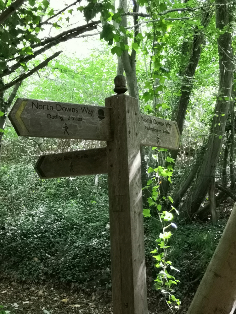
Past experience of walking on long distance paths also tells us that they are very well marked. Just watch out for the acorn symbol, and if in doubt check on your mobile phone. I don’t have my phone constantly navigating as the battery will die after a couple of hours of using the GPS within it.
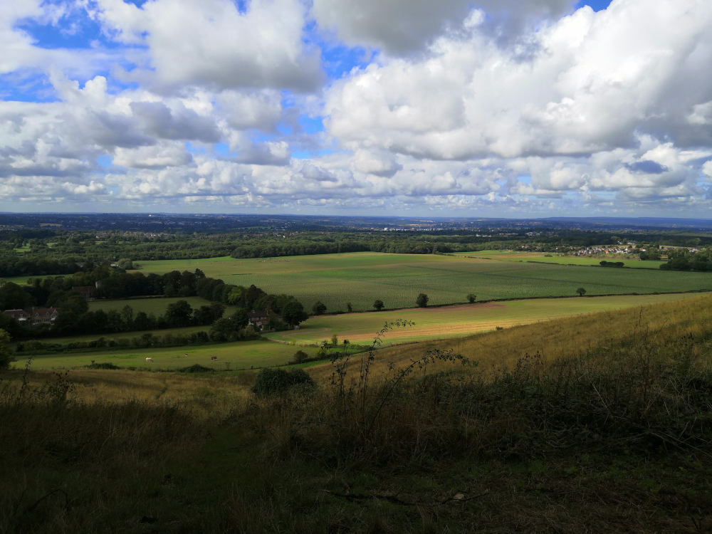
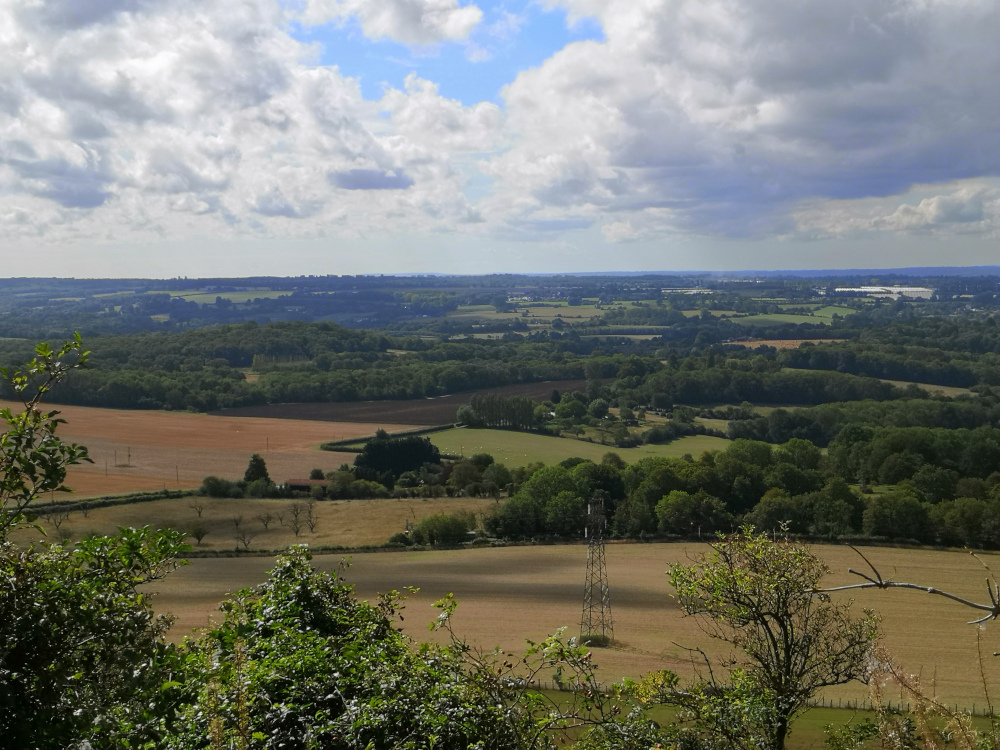
Looking at the map, you could easily imagine that your route will take you along the ridge at the top of the escarpment, but actually you are descending and climbing almost continually, making an interesting but tiring hike - the views are worth it though.
The plan for the day
The weather forecast was good, with little chance of rain, and no significant wind, but it was cold for the time of year and we both carried fleeces. A small lunch, several snacks, and a bottle of water went into the rucksack, joining the cameras and binoculars. Lightweight waterproofs were packed just in case the weather hadn’t read the forecast and decided to surprise us.
The Walk along the North Downs Way
We parked in the car park for the KCC White Horse Wood Country Park, and paid our £1.50 fee for the day. I put a marker on Osmand+ on my phone just in case we were having problems finding our way back to the car at the end of the day, and we set off about 10:30 a.m..
The start of our walk skirted the remains of Thurnham Castle, but we had visited that a few weeks ago, so we didn’t visit today - if you’ve never been there it’s worth spending a few minutes reading the information boards and investigating the ruins.
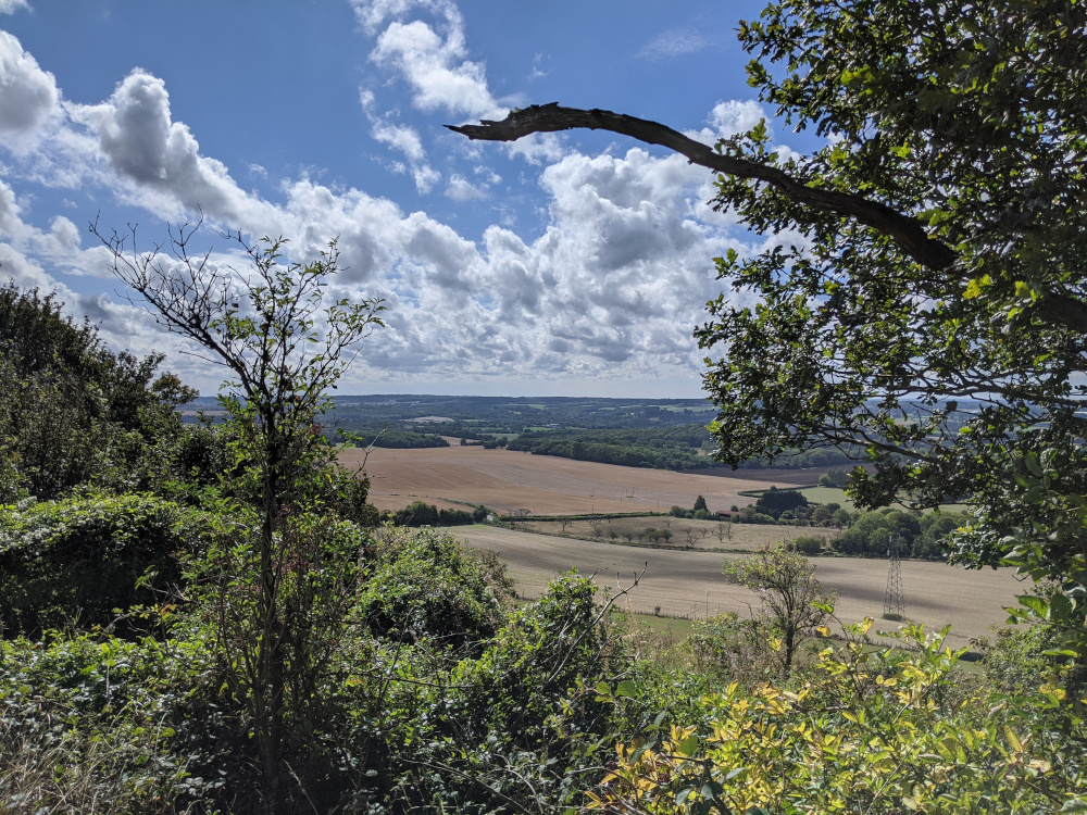
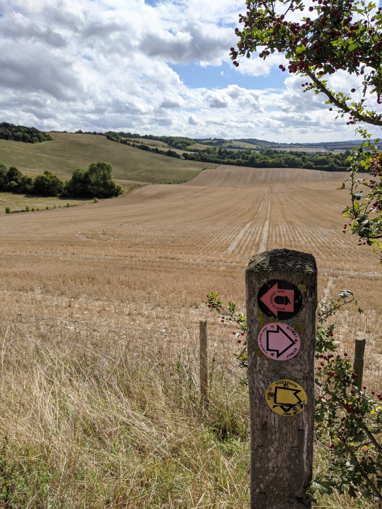
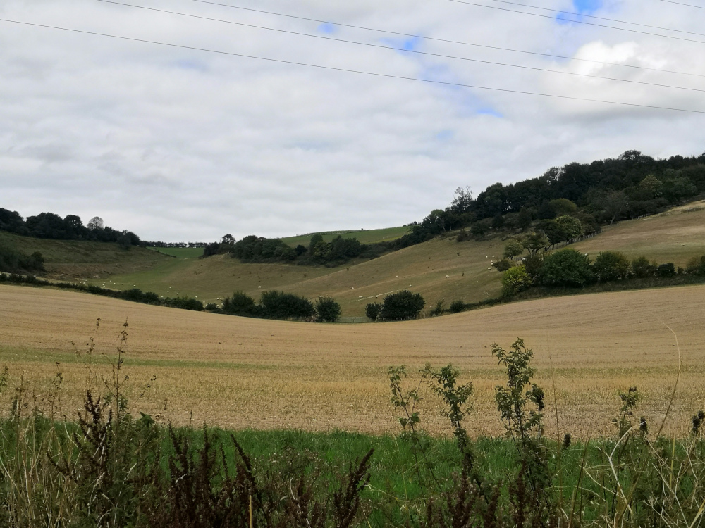
The start of our walk was along a tarmac single track road, going quite steeply downhill, but we followed this for only a short distance and then walked along a firm but uneven footpath with a dry mud and stone surface. We passed through kissing gates with our path climbing, and then falling. We were often in trees, but the views into the valley were spectacular when you left the trees.
Although there are not many benches along the route, we found a fallen tree which made an ideal seat for a snack break. Several sections of the route involved climbing down steps, and then a short distance later climbing up steps to regain the height we had just lost.
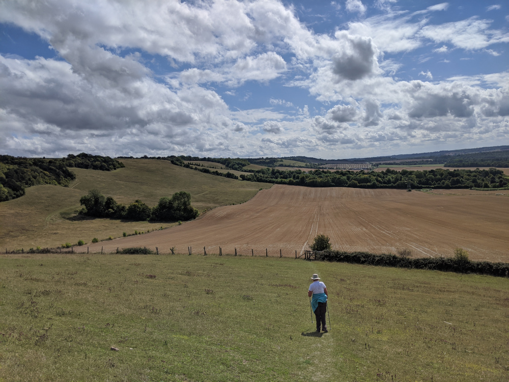
We ate our early lunch sitting in a grassy field with fine views out into the valley.
The Pilgrims Way road route back
Although undulating, the Pilgrims Way road route back is a much easier route to the bottom of the hill below the White Horse Country Park. Up to this point the road forms part of the National Cycle Network, and many cycles were using the road as we walked along it - the cars that we saw seemed to be a little more careful because of this, making the route more pleasant than some roads we have walked.
Although we were enjoying our walk, we were also finding it tiring, and we were pleased to see signs for our turn-round point. We decided to turn the walk into a circular one by descending down one of the byways which cross the route, and then walking along the Pilgrims Way (road - there is also the Pilgrims Way path nearby) back to Thurnham. The climb up the hill from the pub is steep, but it’s easy to smile - you’ve enjoyed the walk and are nearly finished - well done!
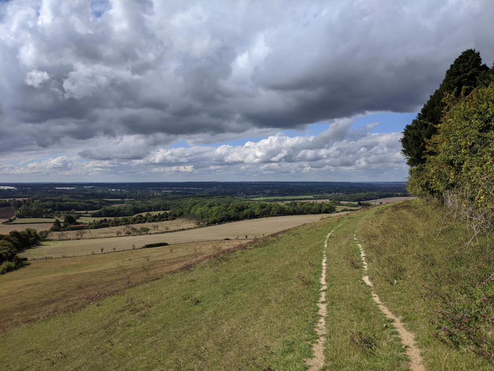
The view from Pilgrims Way, up towards the North Downs Way that we had passed along a short time previously.
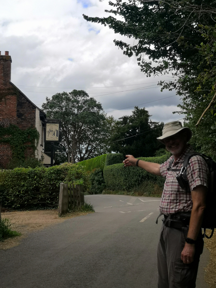
A pub with outside seating and cold beer - a well earnt prize before we climbed the hill back back to the Country Park and our waiting car.
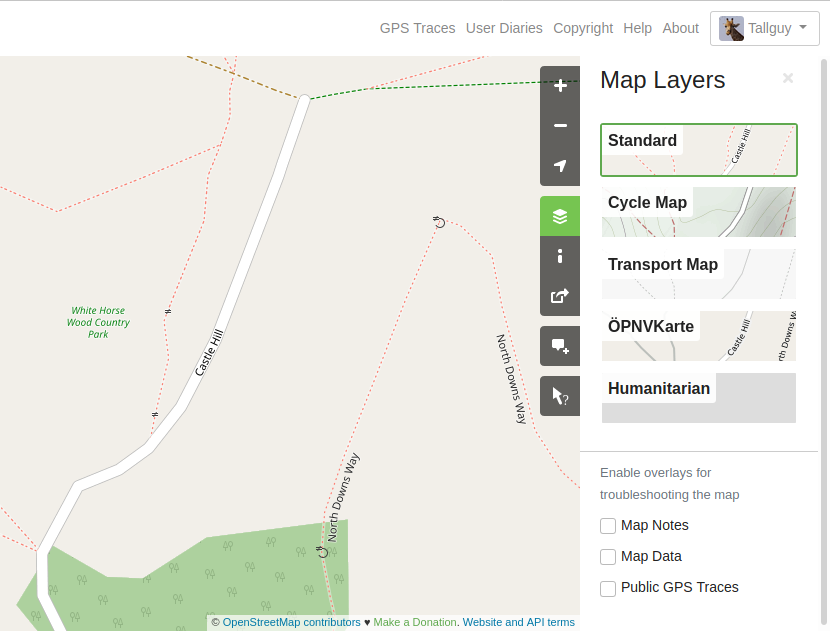
Adding information to OpenStreetMap
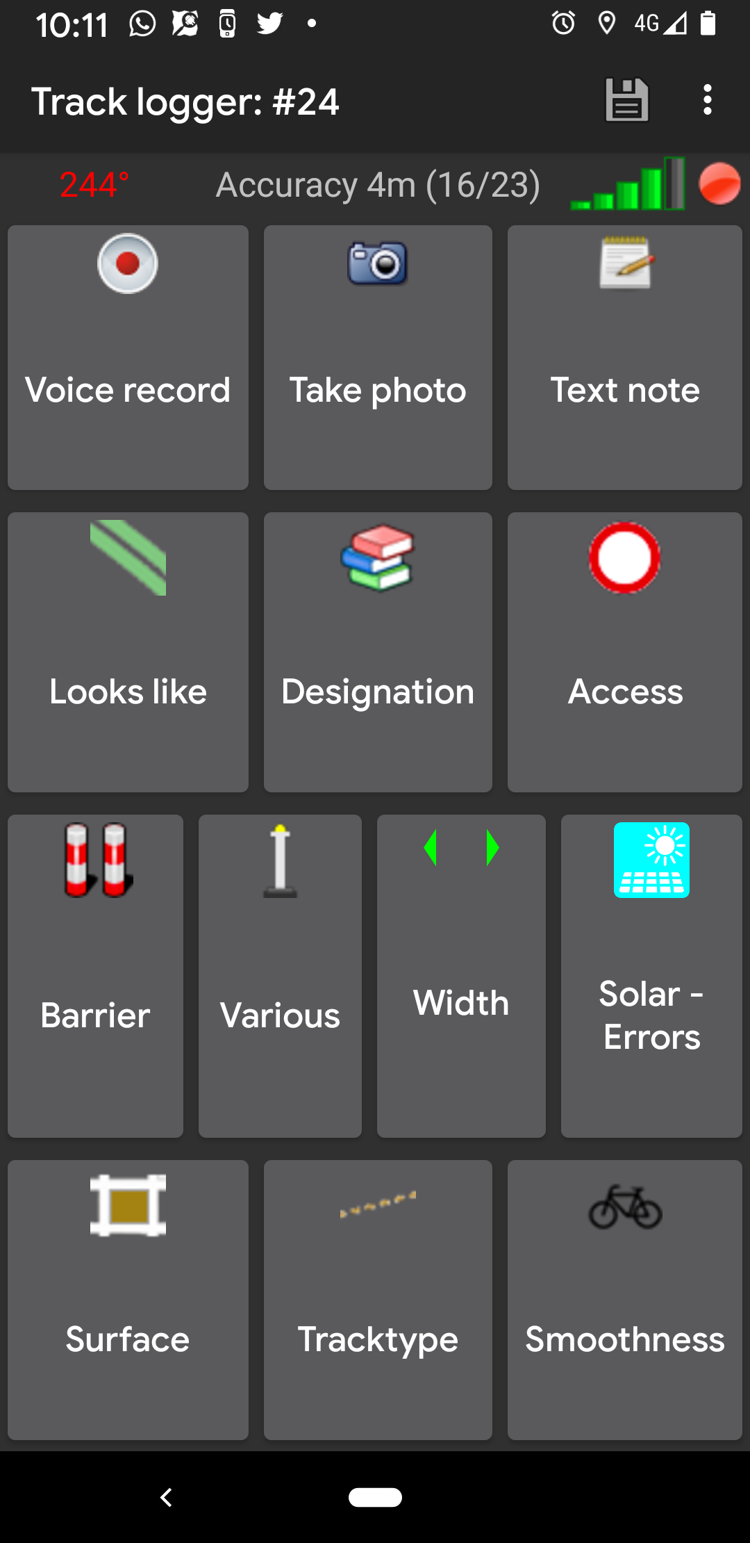
I (Nick) had taken many electronic notes along the way using an Android App OSMTracker, and as we entered the park I realised that one of the paths was missing from OpenStreetMap.
At home on my laptop:
- In my web browser (I am using Firefox, but it should be the same in most modern web browsers) go to https://www.openstreetmap.org and log into or create your account.
- Click on edit (it doesn’t matter which area of the map I was looking at),
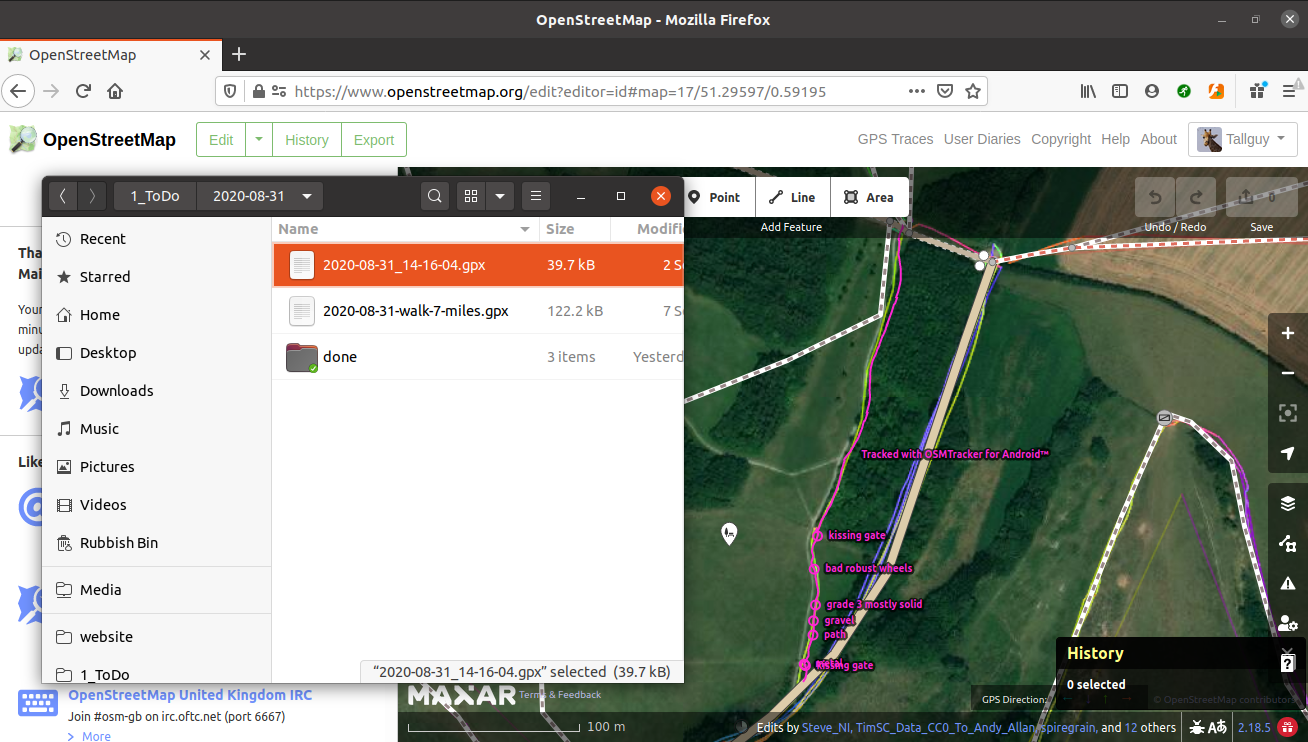
- Using my file manager, I dragged and dropped the OSMTracker file onto my web browser,
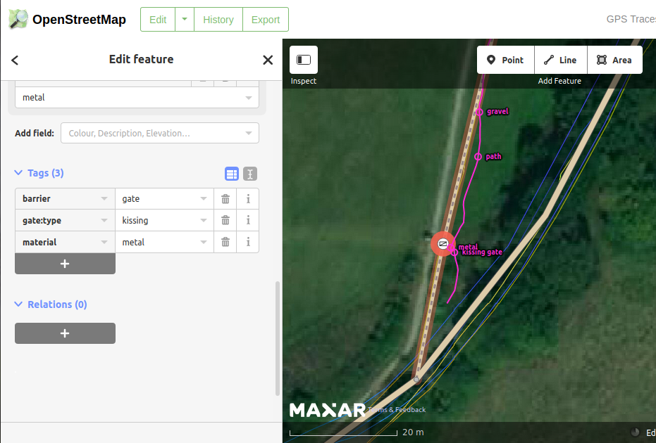
- The web browser then changed to show my gps trace, and showed the buttons I had clicked on OSMTracker. I have both a trace showing where I walked, and a point in each place I clicked on a button, so that I can see exactly where to add features such as a kissing gate.
- Using the layers button on the right of my screen I made sure I was also viewing any other GPS traces which had been uploaded by others. It’s worth bearing in mind that GPS traces can be inaccurate, and yours may be 20 metres ‘out’ - use an average all of the available GPS traces for best results.
If you’ve never edited OpenStreetMap before, you will be presented with a very useful walkthrough, which will help you to get going. There are many other guides on how to edit OSM, such as https://wiki.openstreetmap.org/wiki/Beginners%27_guide.
I’ve done this before, but I often need to check on exactly which tags to add to features, so I usually have one of the tabs on my web browser pointing to the OSM wiki, so that I can check on which tags to use.
Another very useful site for mapping in the UK is https://osm.mathmos.net/, which has a section on Public Rights of Way in the UK, allowing you to read guidance on editing them, but also guidance on any prow’s which may be mssing from OSM.
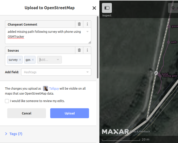
When I was satisfied I had made all of the needed changes, I clicked on the ‘save’ button. I was then presented with a changeset comment screen. This allowed me to add details of why I had updated OSM, and the sources of my information. This information is very useful to anyone editing the features in the future, but also to anyone who is checking on your changes. Many people monitor OSM, checking to make sure that edits add to the map, and are not vandalism, or accidental errors. You may also click on a tickbox I would like someone to review my edits - useful if you have not edited before and you would like an experienced mapper to check your additions and offer advice.
The changeset comment is visible to anyone checking on changes, and can be the starting point for an online conversation about changes. Most people involved in updating OSM will be involved in conversations about changes at some point. I have queried changes with other mappers, and I have been pleased to receive comments when I have inadvertantly made a change with a typo which needed correcting. We all make mistakes at some point - that’s life!
Having made my changes to OSM, and uploaded them, within 5 minutes they were available on the main OSM map - sometimes it can take considerably longer than this - be patient and refresh your web browser at intervals. Mobile phone apps such as OSMAND usually have new versions of the map available monthly, so it could be 2 months before your edits are available to users of that app.