01 Jul 2023
Avenue Verte
The Avenue Verte is a mainly off-road cycle route extending from London to Paris. Depending on your choice of route, you can expect to cover at least 300 miles over the whole route. Much of the route is on old railway lines that have been transformed into very good cycle routes. There is a choice of routes in France.
Daphne & I have known of the route for several years, and were delighted to see a French friend who cycled with her electric bike the whole route, using friends or bed & breakfasts for accomodation.
In 2023 we decided to explore the French part of the route with friends. We have a car & caravan, and they have a motorhome. When cycling we look a little strange, as my cycle is a recumbent trike.

The route has it’s own very handy website at https://www.avenuevertelondonparis.co.uk/.
As is usual for us, the “Avenue Verte” became a long term theme. It allows us to have more than one holiday based around it, and we can dip in and out as it suits us.
We decided on 4 weeks in France, with roughly 3 weeks devoted to the Avenue Verte, and one week exploring the Honfleur area. The English section could follow later, but in truth Daphne & I have cycled most of it in previous years.
A Night near Newhaven

June 2023 saw us set-off with our caravan for a small site near Newhaven, which was ideal - nicely tucked away, and with a short walk available in the grounds to a beautiful nature pond. The site was fairly close to the ferry terminal, so we didn’t have to worry about a long journey in the morning. A fish & chips evening meal with our friends made a terrific start to the holiday.

The early morning ferry Newhaven » Dieppe was a new one to us - quite pleasant really as there was enough time for a meal and an explore of the boat.
First Nights in France - Dieppe
A short drive from the ferry port and we were at our first campsite with a fishing lake and two rivers. All the facilities we needed to allow us to acclimatise, and the Avenue Verte running past the back of ths site within a few metres of an entrance - ideal!

The next day we cycled along the route » Dieppe - it rained!

The route was much better than we had expected - mainly tarmac on old railway lines, and mostly extremely well signed.

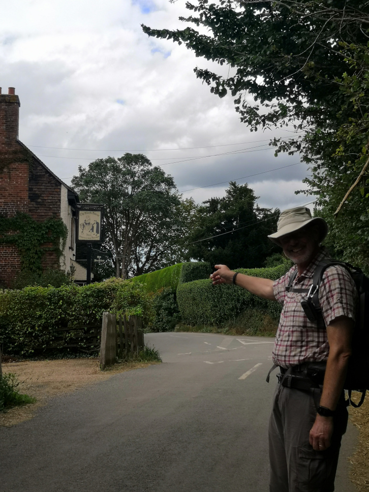
Dieppe harbour was good - nice seafood restaurant, and we were ready for some sightseeing again. But….. Just when you think everything is going well, life springs another surprise.
Daphne stopped at a junction, put her foot down, and her foot slid away from her on loose gravel. She crashed to the ground with the bike landing across her lower leg. Ouch.. She gamely continued on, but we could see she was in pain. That evening I drove her to the hospital - not broken, but very badly bruised. You will need a compression sock for some weeks, and you will need painkillers We need to praise the French Hospital staff, as they were very helpful & efficient - they were also very patient with our halting pigeon French - Thank you.
Maisons Laffitte & the start / finish of the Avenue Verte
An easy drive from Dieppe, and on the banks of the river Seine our campsite at Maisons Laffitte had all the facilities we needed, and was ideal for Daphne, who was finding any kind of exercise difficult and painful. It’s train station was ideal for a day trip into the centre of Paris.

We spent several days exploring the local area, and Daphne’s leg improved a little. The cafe’s and restaurants enjoyed our company, and we relaxed.
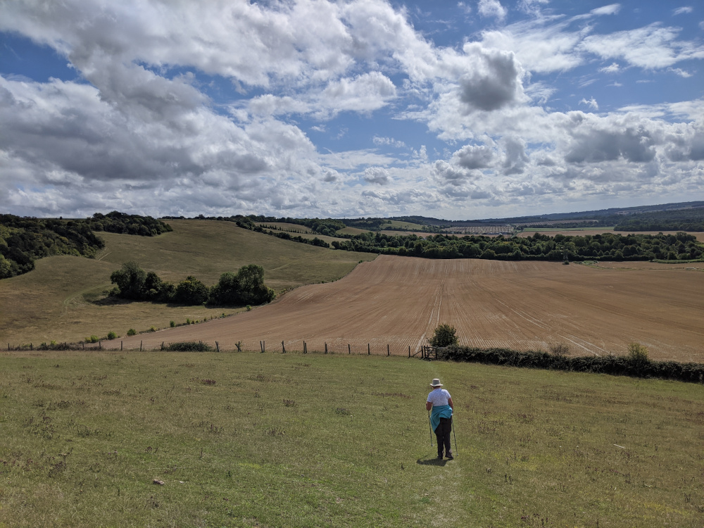
But Nick wanted to cycle in Paris! The round trip from the campsite along the Avenue Verte would be over 60 miles, and the electric trike had about that as a range - it was possible, just. Oh, and the weather had turned hot, in fact very hot, with temperatures of over 30 degrees centigrade.
Nick setoff at 5am, with two full water bottles, plus a 2 litre water container in his back pack. Once over the river, the route was really enjoyable - mainly along a track close to the river, with plenty of trees providing shade. Navigation was easy, Nick had downloaded all of the .gpx tracks available for the route and loaded them into his old faithful Garmin Edge Touring, which was happily telling him about every upcoming turning, and lighting up at every feature. But then the roads became busier, and the route more complicated. The electric trike is good, and comfortable, but light it is not. Picking it up is possible, but carrying it any distance is not. This isn’t a good thing to find on the route…. »

The little ramp at the edge of the steps is great if you have a two wheeled bike, but no good at all for a trike. Time to study the garmin, and maps. The old garmin was showing several cycle routes in the area, and it looked as if there would be a fairly easy detour around the bridge to get back onto the route. Oh, and there was a very clean public toilet nearby, which was handy because Nick was so worried about getting dehydrated in the heat that he needed a loo! After a short break for planning Nick setoff into the early morning rush hour traffic with the Garmin suggesting a route - but this didn’t go well. Each time he left the route the Garmin would recalculate, and dealing with traffic in a foreign land meant frequent stops to try to work out where to go. After 30 minutes of constantly having to recalculate the Garmin decided it was going to stop playing, and just continually display ‘recalculating’. Never mind, the phone has a very good mapping system on it - it’s just that you can’t easily use it whilst cycling. Pick a direction, cycle for 10 minutes, and then check on progress on the phone. Things were not going to plan, and it took a long time to get over this little hiccup. Plan ‘B’ emerged - just head for the centre of Paris, using any cycle lanes you can find (The Avenue Verte seemed to have vanished completely by this time).

There is a sort of peripherique of small roads each with a cycleway aroung L’Arc de Triomphe, and this avoided the frightening prospect of joining the traffic around the monument itself. From there, it’s all downhill to the centre of Paris, and the start of the Avenue Verte next to Notre Dame.

Notre Dame suffered severe damage from a fire some time ago, and is still undergoing repairs - Nick was very pleased to see that progress is being made on its restoration.
The old Garmin was turned off, given a few minutes rest, and then turned on again. The phone was consulted. Good, there were cycle routes But, there were many cycle routes, and on the phone and Garmin SatNav it was very difficult to see which one(s) were the Avenue Verte. There were road signs - everywhere, and there was traffic, and there were pedestrians, and there were other cyclists. In fact the other cyclists were one of the main problems - they were quick and Nick wasn’t. Revert to studying the phone, then cycling for a couple of minutes before studying the phone again. Slow progress, but soon Nick was onto the right route, and a small cafe beckoned - coffee and a bottle of water - oh, and a croissant. Things were looking up!
The route joined a canal, and according to the map it didn’t matter which side of the canal you were - nearly true, but navigating this sort of a problem is half the fun. There were a couple of places where roadworks signs diverted cyclists away from the original route, and a new route was being built - it all took time to navigate, and was very ‘stop start’, but it was good to see so many new cycle routes being constructed.
Nick was pleased with himself, as he had managed to mainly follow the Avenue Verte, and now he was next to the Seine again - but he knew that the bridge with all its stairs was ahead of him. After a study of the map he made a mental note of a road name where he needed to turn off of the route, and then follow his own diversion to get around the bridge. Plan ‘C’ was made, and then abandoned, as another diversion sent him away from the Seine, and there didn’t seem to be a way back again. Plan ‘D’ involved navigating to a point past the bridge, and back onto the route again. This meant cycling along a path next to a main road, but at least it was progress in the right direction.
Back at the nice clean public toilets, past the bridge, and back onto the route next to the Seine. The phone was nearly dead, displaying less than 5% battery remaining, and the Garmin was also warning of impending shutdown because of a dying battery. Still, navigation was not needed, as Nick now knew where to go. About 2 miles from the campsite the trike’s electric assist stopped working - flat battery, and progress slowed, but was still being made.
Nick made it back to the campsite almost exactly 12 hours after he left.

A very satisfying days ride, and the first time of riding so far that the electric assist packed up. This seemed to be mainly caused by the constant stop-start. On a flat road without navigation problems Nick normally rattles along at between 15mph & 17mph, which means that the electric assist is hardly being used, and the range extends to over 90 miles - this was not the case today.
Another thing to emerge from the day, was Nick’s realisation that a better method of navigation was needed. The Garmin is good, in fact he has several old different one’s and they are all good, but they can only display the mapping data they are loaded with. In Paris, and other large towns or cities there are now numerous cycle routes, and the problem is more a case of trying to find out which is the ‘right’ cycle route - in this case the Avenue Verte. Nick has created Garmin compatible maps from OpenStreetMap data before, and an idea was emerging - please see the Garmin-Maps section of this site.
13 Sep 2020
Background
2020 was the year of covid-19, and many holidays were cancelled and plans changed. We (Daphne & Nick) decided we would like to have a share in a narrowboat again, and after some investigation we bought a 12% share in narrowboat Maia. We had previously owned a share in another boat (Apperley) for about 10 years, with BCBM (https://www.bcbm.co.uk/) as the managing agents, and were happy to use them again.

Sunday 13th September 2020 - Our first day on Maia
 Charles from BCBM met us at Alvechurch Marina, and gave us a thorough introduction to Maia. A very pleasant surprise - we were also given a bottle of bubbly to welcome us as new owners to Maia! We were looking forward to taking her out, but pleased to learn about her.
Setting off along the canal our first impressions were good, and we soon reached a good mooring spot, 3/4 mile before Hopwood. We intended to eat on board, but Hopwood House beckoned for a quick beer, and that became a meal (very nice).
Monday 14th - Bittall Reservoir & Lickey Hills 8km walk
Monday started bright and early with a 8.4km (5.25 miles) walk. We started from our mooring on the canal, along the canal towpath before climbing steadily, through the Bittall reservoirs and then along paths and tracks to the Lickey Hills Country Park, where we enjoyed coffee and cake at the visitor centre cafe. Our walk back was much easier, mainly downhill. We thoroughly enjoyed the walk, but found it quite a strenuous climb to the Park. Not back to the boat until mid-day.
We meandered on to Earlswood in beautiful weather and had a BBQ on the towpath.
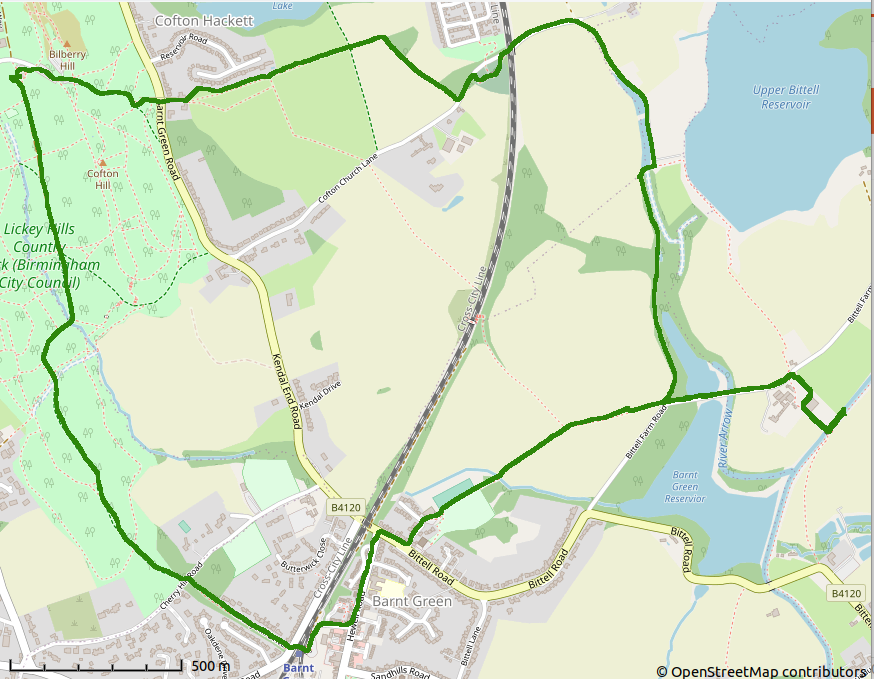


That evening we enjoyed our bottle of bubbly with a BBQ beside the canal.
Tuesday 15th - Earlswood Reservoir 10km walk

Lovely walk, longer than we anticipated at over 7 miles, to Tanners Green, Forshaw Heath & Earlswood Reservoirs.

Having started later than we had planned, we reached the Lapworth Locks, and then realised we had, once started, to keep going until we could get through the locks and find somewhere to moore. 24 locks later we tied up, very tired! Our initial plan had been to moor a few locks back near to The Boot pub, but the moorings were all full and below the junction was the earliest we could tie up. The couple in front of us were still learning, and we helped them a little, which slowed us slightly.
Wednesday 16th - Wootten Wawen


We continued through locks, again a gorgeous day, and we had lunch near to the Craft Centre at Wootten Wawen. Daphne managed to buy a replacement chain for her SOS talisman. We continued, crossing the Edstone Aquaduct, then winding (turning round), recrossing the aquaduct and then mooring for the night. We walked back, over the aquaduct, then under it and round it - quite a feet of engineering.
Thursday 17th - Preston Baggott

As we worked our way back up the locks, we met ‘Debbie’ a lady operating her boat ‘Europa’ on her own - very skilled, like watching one of the boatmen of old. She was nearly as fast working on her own through the locks, as we were working as a couple.
An elderly muscovy duck was sitting next to one of the locks - but he managed to move when Daphne appeared with the duck food.
We moored just after lock 25 and went on a loverly short walk along Dicks Lane to the Grand Union canal where we found the ‘Tom of the Wood’ pub - very nice, and dog friendly.

Friday 18th - Lapworth Locks and Earlswood Reservoirs
We knew we had a flight of locks to climb, so started fairly early - we were underway about 8:30am. Luckily for us, 2 lock keepers were doing some kind of assesment exercise and decided to help us up through the locks whilst doing it, which took us fairly quickly up about half of the flight. When they left we settled into a fairly fast rythm, and found we had caught up with Debbie, who was working the locks on her own, but very efficiently and quickly. The two boats and three people made fairly quick progress up the rest of the flight. Debbie stopped near the top, but we continued, dropped into Wedges Bakery, and then moored near to the Earlswood reservoirs.


Our afternoon / evening walk was around part of the Earlswood Reservoir nature reserve. The Red Lion pub was on our route back to the boat - very nice beer we found. When we later looked at the map we realised we had only been round about 1/4 of the reserve. Plenty more for next time!

Plan ‘A’ had been a BBQ, but it was cold by the time we returned to the boat, so plan ‘B’ involved Daphne cooking dinner in the oven. We finished off with enormous apple struddle slices we had bought from Wedges Bakery - gorgeous!
Saturday 19th - Return to base
8:30am start. An uneventful day if you don’t notice that Daphne tripped and fell near the remote controlled liftbridge. Luckily she seemed to suffer very few ill effects and we continued along the canal, through the tunnels, and back to base by 3:00pm.

A short walk on the way back - only 1.6 miles, and we had a quick look at the short aquaduct on the aptly named Aquaduct Lane. Daphne rescued a horse that had managed to get his hoof caught up in a wire fence - this may have been his, attention seeking, party trick!
01 Sep 2020
OpenStreetMap (OSM) is an open source project with over 1 million contributors. It was conceived in 2004 & is now one of, if not the, best mapping resource in the world (Nick’s viewpoint!).
Nick has been involved in updating OpenStreetMap since 2008.
Nick
‘I grew up using Ordnance Survey Maps, and had complete faith in them. I also used other paper maps on occasions, but I started to realise there were limitations. On one occasion Daphne & I bought the latest OS map of an area for a holiday, and also invested in an electronic version to use on our Palm PDA’s. We went on several walks and cycle rides, but were disappointed when we found that both were out of date, leaving us stranded the wrong side of barbed wire fences or cycling along busy dual carriageways that didn’t even appear on the maps.
I got involved in OSM because it was interesting, and although there were initially many errors in the mapping, that made it no better or worse than the maps I had bought. At least with OSM I had the opportunity to correct the errors, and add the data.
I can remember a holiday in Germany where we had an OSM map on our Garmin, and I realised that every street in the remote village we were passing through had its name on OSM, the shops were all shown, together with their opening hours, and in fact the whole area was beautifully mapped. It gave me the incentive, when home again, to make sure my area was mapped with as much detail as possible.’
A few examples of OSM use
- Mobile phone navigation, including Osmand, Maps.me, Cyclestreets, MapFactor Navigator, Navmii GPS
- The British Red Cross, Medecines Sans Frontieres (Doctors Without Borders), American Red Cross and many other charities. (See https://www.missingmaps.org/ for more info and a full list of charities who are encouraging volunteers to map needy areas).
- As well as basic map usage for navigation, GIS experts are able to provide information to charities - population estimates, drinking water sources & possible problems, likely mosquito areas (helpful when working towards reducing Malaria).
- Maps are available in Garmin format, making up-to-date maps available for all of the world (quality can vary, but that should be understandable really!).
- Some delivery drivers & firms use the data (Amazon have a team of ‘mappers’ adding data to OpenStreetMap).
- As its an open source project, there are opportunities for computing study students to learn, add to, and prove themselves in an environment that encourages participation.
- The base map for many sites such as Strava and Geocaching.
Research resources for OpenStreetMap
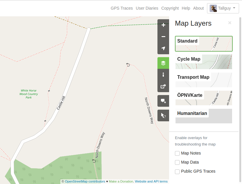
 https://www.openstreetmap.org - the main page. If you would like to get involved, then create your login account here. Make sure you click on the layers icon on the right side of the screen to get an idea about how the same data can be transformed to appear differently.
- https://wiki.openstreetmap.org/wiki - The when, where, how & why of OpenStreetMap. It’s a terrific resource & worth investigating.
- https://learnosm.org/en/ - Translated into many languages, this site aims to help you get started with OpenStreetMap. If you are completely new to OSM, then reading the Introduction & OpenStreetMap.org modules of the beginner section should help you to understand more. Nick is biased as he contributes to this site.
- You may find a few entries on this and other sites that help you to get started. Personally I’ve found that learning and then using have given me enormous satisfaction - Nick. Make sure you click on the ‘hamburger’ icon top left to access the menu on this site.
Getting involved
Head over to https://www.openstreetmap.org and login - you may need to create an account, and you will have to supply an email address. Make sure you read the advice about contributing - we cannot copy from other people’s maps, except if they have given express permission, or the maps are so old they are out of copyright.
Uploading GPS traces
GPS traces on 01/09/2020
 Once you have your account, perhaps you could upload a GPS trace? This link https://www.openstreetmap.org/#map=17/51.29703/0.59188&layers=G shows OpenStreetMap for the White Horse Wood Country Park, with the uploaded GPS traces shown. The screenshot to the right is of the area with the gps traces present on the 1st September 2020.
GPS traces on 17/09/2020
 This screenshot shows the GPS trace which I have uploaded, showing the path that needs adding.
Creating your own GPS trace & uploading it
In order to get the best trace possible, make sure you set your device (phone or GPS) to take a reading every second. When you first switch it on, wait for a few seconds so that the device gets an accurate reading - if you are under trees, in a canyon, it’s a cloudy day, or if there is some other problem you may find it takes more than a few seconds. Relax, take your time - you’re doing this for fun and so you can contribute ‘your bit’. The path will still be there in five minutes!
31 Aug 2020
Statistics
Total distance walked: 7 miles or 11.1 km
Total Elevation Gained: 1515 ft or 462 metres
Warnings & possible wheelchair access
Warning: Sections of this route include steps, and stiles - not wheelchair friendly. Some kissing gates are narrow. I will be updating OpenStreetMap so that the areas of steps, and the types of stiles are visible. Most of the ground is uneven but when we walked the paths they were mainly dry and firm underfoot - they look as if they will be very slippery in wet conditions.
Dog access
Dog access There were very few stiles with access for dogs, and you will probably have to help your dog over many of the stiles. I did not notice any ‘dog poo’ bins along the route. Some fields do contain livestock.
Background
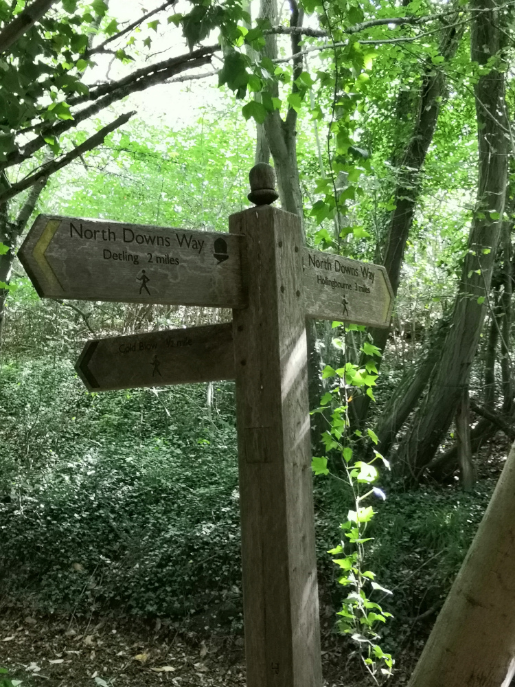
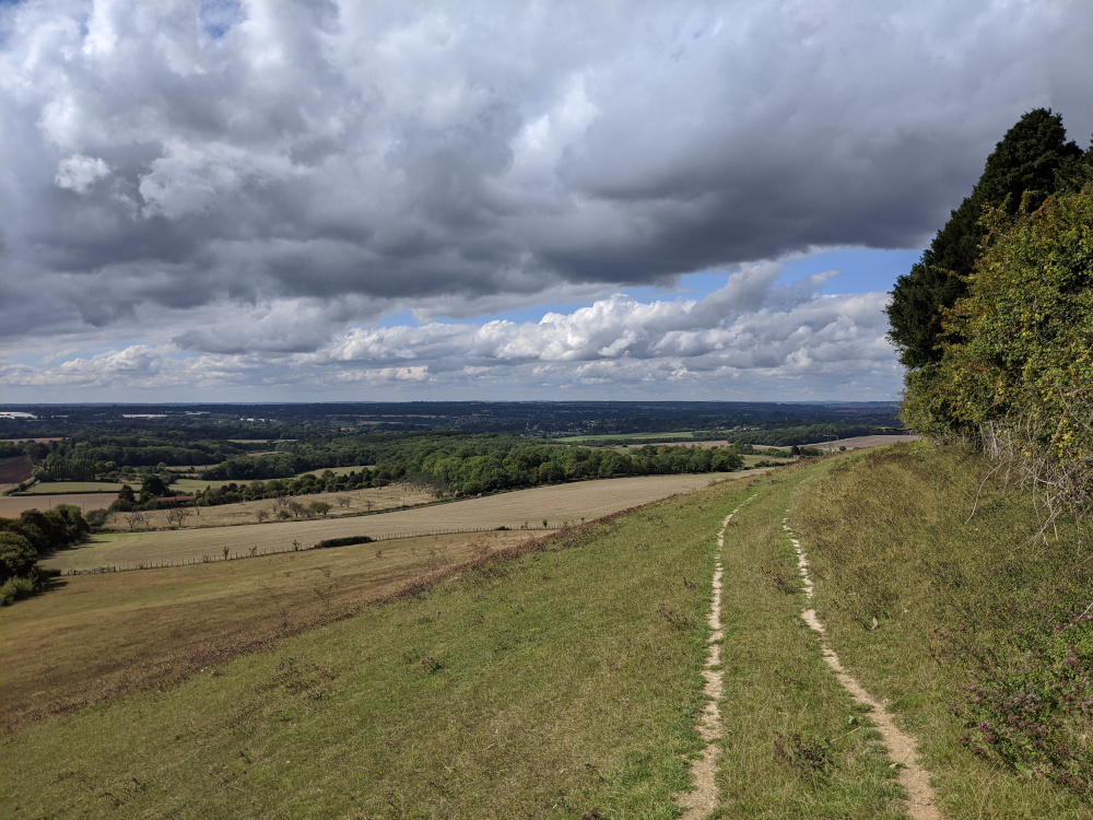
The North Downs Way has been a long term project for us, which we first started several years ago. Living fairly close to the route made access relatively easy, and we were also able to use public transport for many of the segments. We’ve reached the stage now where we prefer a hike of about 6 miles, although we can exceed this if needed.
Daphne is in the waiting list for a knee replacement, and difficult terrain can make life painful for her. She’s been told that the exercise that she is doing is good, and to keep it up - paracetamol is always in our first aid kit, and she uses walking poles in areas involving a lot of climbing and descending - just about the whole of the North Downs Way, really!
Navigation for the day
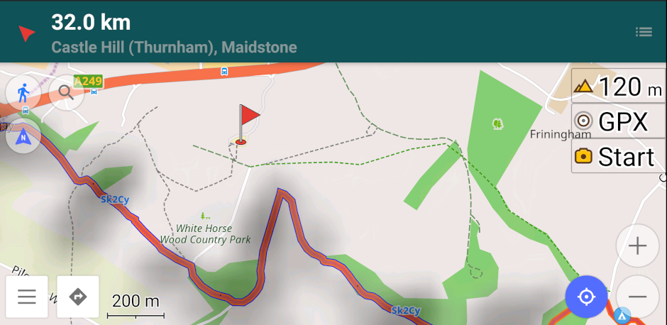
I use Osmand+ on my Android phone, and it makes navigating along long distance paths really easy. In this screenshot the North Downs way has the tag Sk2Cy.
Past experience of walking on long distance paths also tells us that they are very well marked. Just watch out for the acorn symbol, and if in doubt check on your mobile phone. I don’t have my phone constantly navigating as the battery will die after a couple of hours of using the GPS within it.
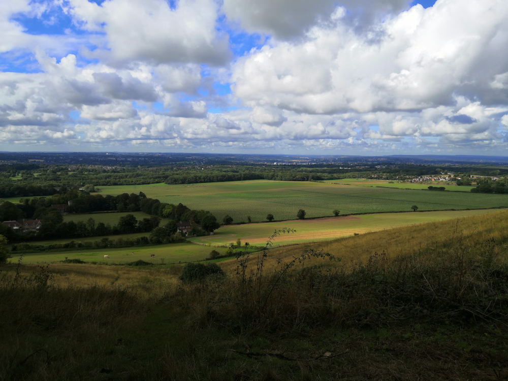
Looking at the map, you could easily imagine that your route will take you along the ridge at the top of the escarpment, but actually you are descending and climbing almost continually, making an interesting but tiring hike - the views are worth it though.
The plan for the day
The weather forecast was good, with little chance of rain, and no significant wind, but it was cold for the time of year and we both carried fleeces. A small lunch, several snacks, and a bottle of water went into the rucksack, joining the cameras and binoculars. Lightweight waterproofs were packed just in case the weather hadn’t read the forecast and decided to surprise us.
The Walk along the North Downs Way
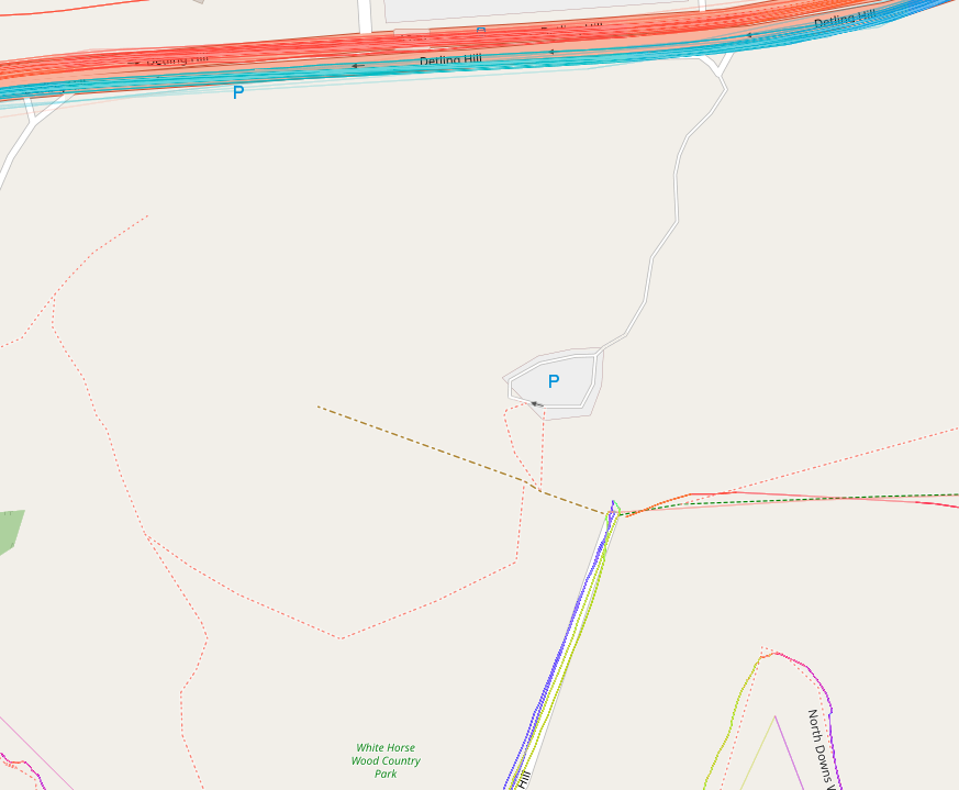
We parked in the car park for the KCC White Horse Wood Country Park, and paid our £1.50 fee for the day. I put a marker on Osmand+ on my phone just in case we were having problems finding our way back to the car at the end of the day, and we set off about 10:30 a.m..
The start of our walk skirted the remains of Thurnham Castle, but we had visited that a few weeks ago, so we didn’t visit today - if you’ve never been there it’s worth spending a few minutes reading the information boards and investigating the ruins.
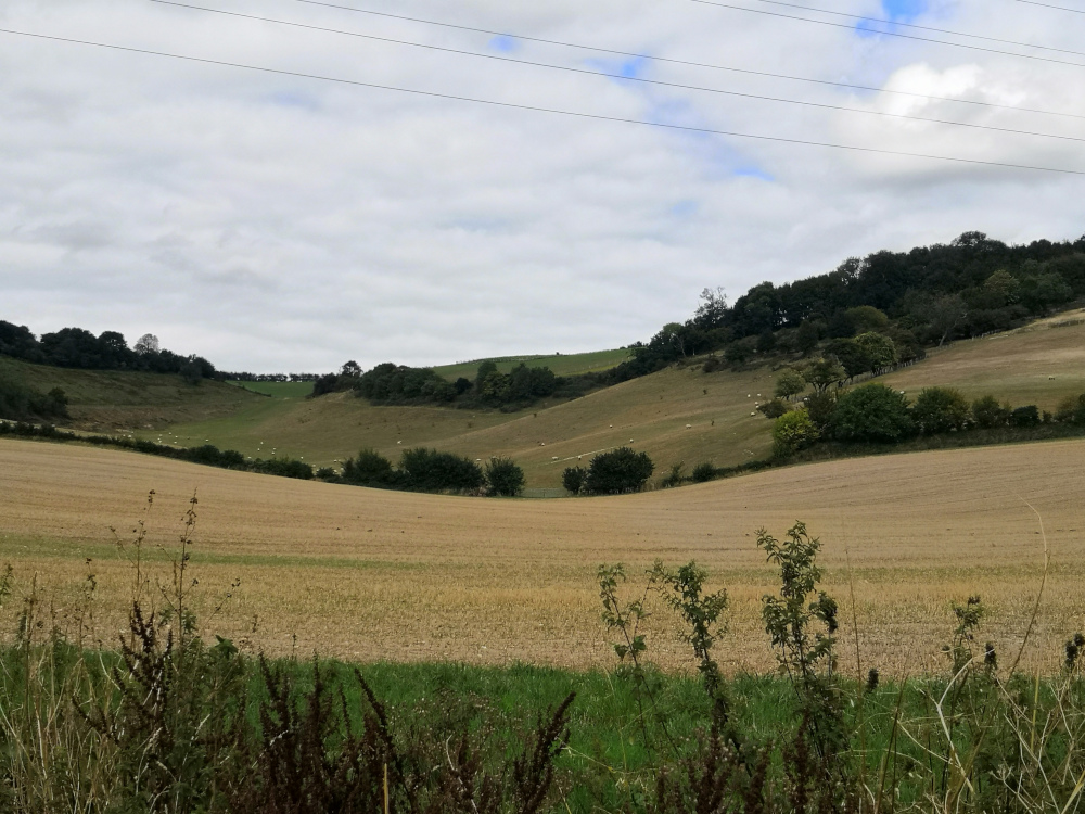
The start of our walk was along a tarmac single track road, going quite steeply downhill, but we followed this for only a short distance and then walked along a firm but uneven footpath with a dry mud and stone surface. We passed through kissing gates with our path climbing, and then falling. We were often in trees, but the views into the valley were spectacular when you left the trees.
Although there are not many benches along the route, we found a fallen tree which made an ideal seat for a snack break. Several sections of the route involved climbing down steps, and then a short distance later climbing up steps to regain the height we had just lost.
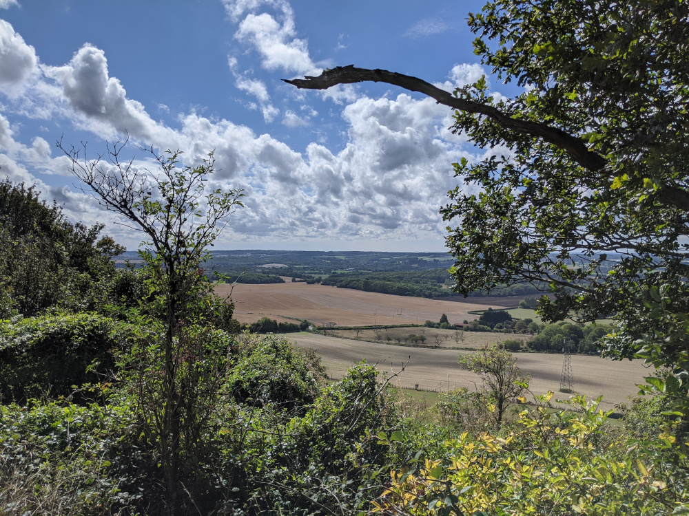
We ate our early lunch sitting in a grassy field with fine views out into the valley.
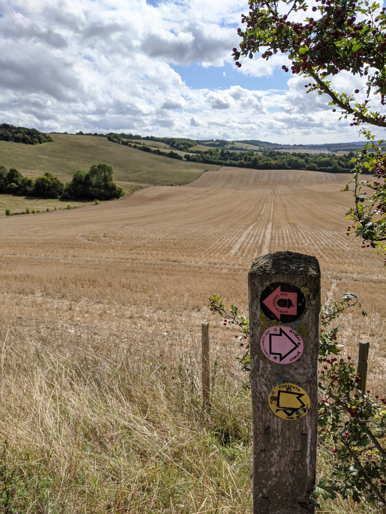
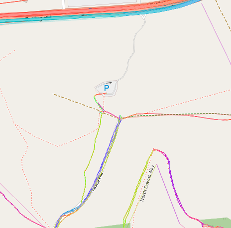
The Pilgrims Way road route back
Although undulating, the Pilgrims Way road route back is a much easier route to the bottom of the hill below the White Horse Country Park. Up to this point the road forms part of the National Cycle Network, and many cycles were using the road as we walked along it - the cars that we saw seemed to be a little more careful because of this, making the route more pleasant than some roads we have walked.
Although we were enjoying our walk, we were also finding it tiring, and we were pleased to see signs for our turn-round point. We decided to turn the walk into a circular one by descending down one of the byways which cross the route, and then walking along the Pilgrims Way (road - there is also the Pilgrims Way path nearby) back to Thurnham. The climb up the hill from the pub is steep, but it’s easy to smile - you’ve enjoyed the walk and are nearly finished - well done!
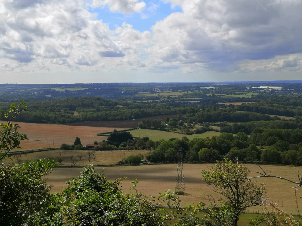
The view from Pilgrims Way, up towards the North Downs Way that we had passed along a short time previously.
A pub with outside seating and cold beer - a well earnt prize before we climbed the hill back back to the Country Park and our waiting car.
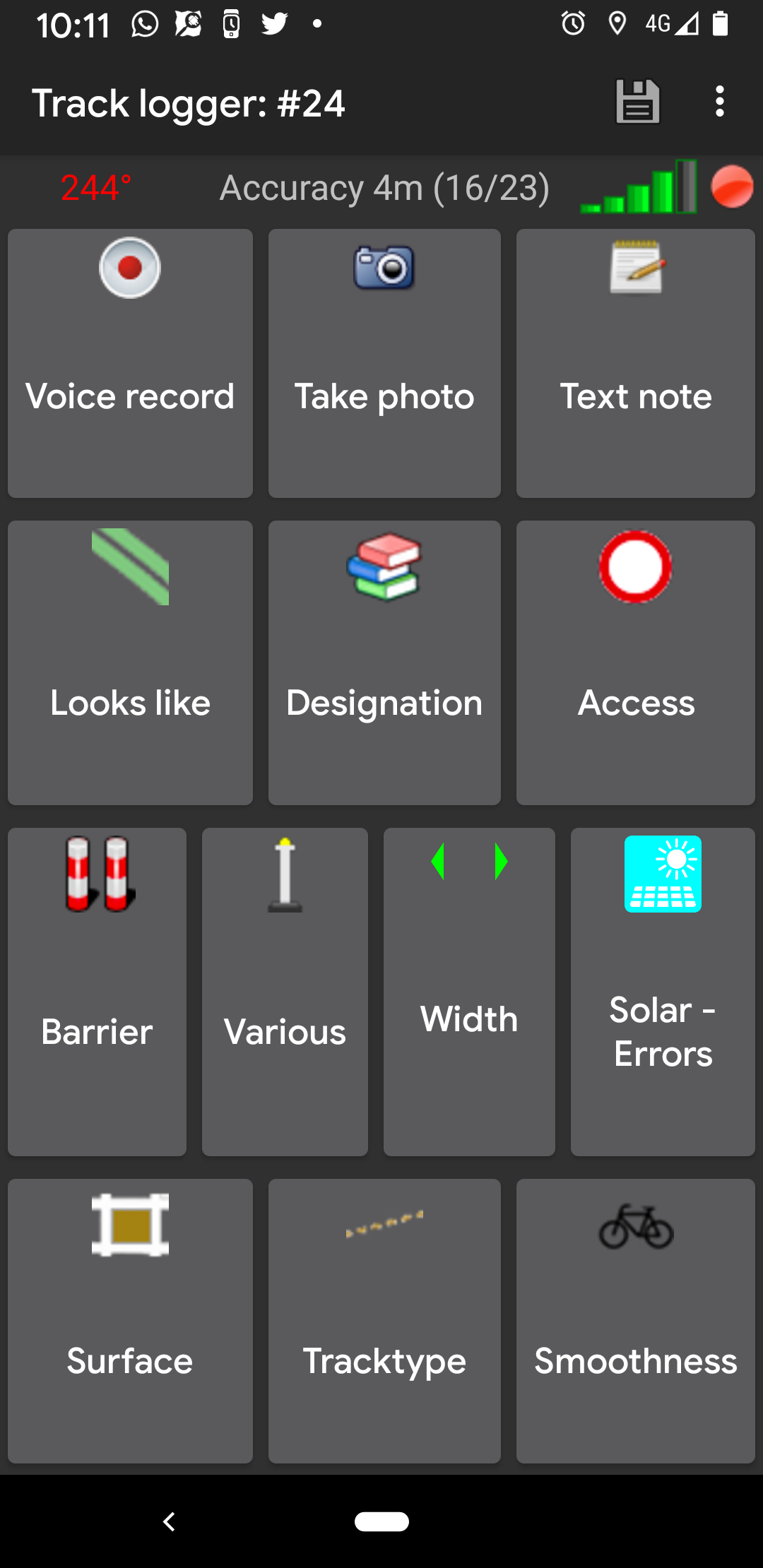
I (Nick) had taken many electronic notes along the way using an Android App OSMTracker, and as we entered the park I realised that one of the paths was missing from OpenStreetMap.
At home on my laptop:
- In my web browser (I am using Firefox, but it should be the same in most modern web browsers) go to https://www.openstreetmap.org and log into or create your account.
- Click on edit (it doesn’t matter which area of the map I was looking at),
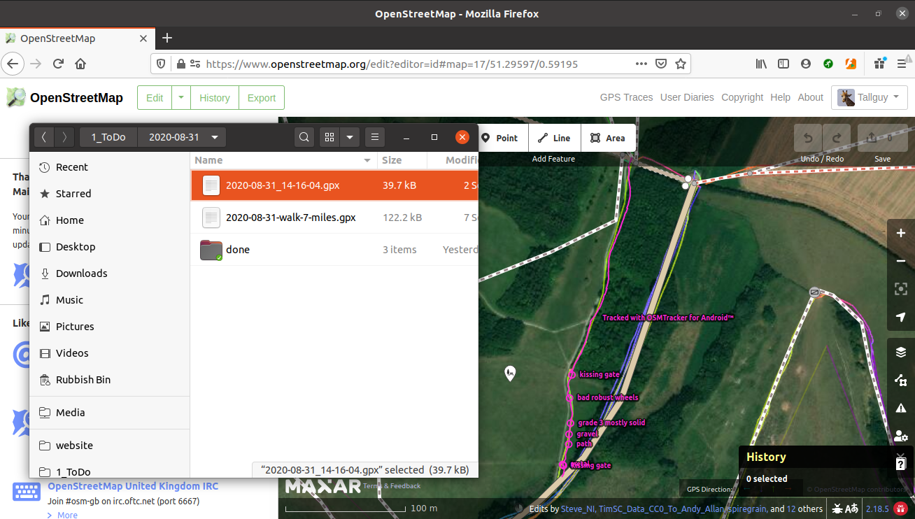
- Using my file manager, I dragged and dropped the OSMTracker file onto my web browser,
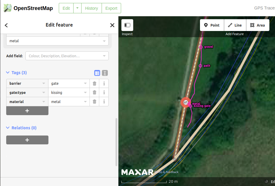
- The web browser then changed to show my gps trace, and showed the buttons I had clicked on OSMTracker. I have both a trace showing where I walked, and a point in each place I clicked on a button, so that I can see exactly where to add features such as a kissing gate.
- Using the layers button on the right of my screen I made sure I was also viewing any other GPS traces which had been uploaded by others. It’s worth bearing in mind that GPS traces can be inaccurate, and yours may be 20 metres ‘out’ - use an average all of the available GPS traces for best results.
If you’ve never edited OpenStreetMap before, you will be presented with a very useful walkthrough, which will help you to get going. There are many other guides on how to edit OSM, such as https://wiki.openstreetmap.org/wiki/Beginners%27_guide.
I’ve done this before, but I often need to check on exactly which tags to add to features, so I usually have one of the tabs on my web browser pointing to the OSM wiki, so that I can check on which tags to use.
Another very useful site for mapping in the UK is https://osm.mathmos.net/, which has a section on Public Rights of Way in the UK, allowing you to read guidance on editing them, but also guidance on any prow’s which may be mssing from OSM.
When I was satisfied I had made all of the needed changes, I clicked on the ‘save’ button. I was then presented with a changeset comment screen. This allowed me to add details of why I had updated OSM, and the sources of my information. This information is very useful to anyone editing the features in the future, but also to anyone who is checking on your changes. Many people monitor OSM, checking to make sure that edits add to the map, and are not vandalism, or accidental errors. You may also click on a tickbox I would like someone to review my edits - useful if you have not edited before and you would like an experienced mapper to check your additions and offer advice.
The changeset comment is visible to anyone checking on changes, and can be the starting point for an online conversation about changes. Most people involved in updating OSM will be involved in conversations about changes at some point. I have queried changes with other mappers, and I have been pleased to receive comments when I have inadvertantly made a change with a typo which needed correcting. We all make mistakes at some point - that’s life!
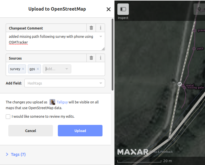
Having made my changes to OSM, and uploaded them, within 5 minutes they were available on the main OSM map - sometimes it can take considerably longer than this - be patient and refresh your web browser at intervals. Mobile phone apps such as OSMAND usually have new versions of the map available monthly, so it could be 2 months before your edits are available to users of that app.
14 Aug 2020
Daphne & I have spoken about a ‘blog’ for several years. It’s been a strange year, several planned trips have been cancelled, and we’ve never travelled so little. But it does mean we’ve had more time at home - and now it’s time to try out a website blog of our own.
A few of our past travels
We have many interests, and travel has been included in most of them. We also enjoy our family, and find that leaving them for long periods of time is our main regret. However, in this day and age we can generally keep in touch somehow, and most places in the world have an airport nearby if we really need to get back urgently.
We love canal boats and canal holidays, and have had at least one holiday on the canals every year since about 1978.
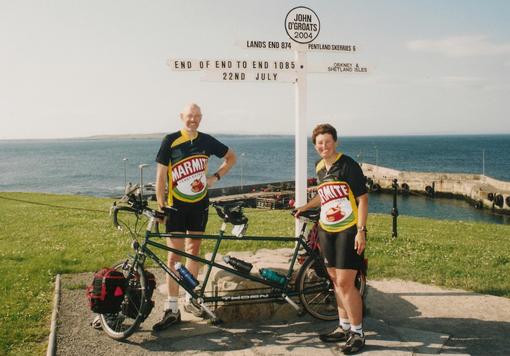
In 2004 we cycled from Lands End to John O’Groats (LE JOG), staying in Bed & Breakfasts or Youth Hostels. Our two children were now adults and we thought it was time for us to play. Were we fit, healthy and prepared for this trip - ….er No. We were so unsure that we only booked accomodation for the first 5 nights, and planned to have some kind of holiday in Wales if the complete expedition was not working out.
In 2005 we were looking for an expedition to try, and found a Cicerone Guide to cycling the Loire Valley. We were hooked! We were also surprised to find that the total distance involved would be less than the distance we had cycled for LE JOG. It didn’t spoil it for us, but it would have been a really good idea to start at the top of the mountain, instead of the bottom! We found this such a beautiful part of the world that we faltered halfway along the route & had to return the following year to finish it off.
2015 saw us exploring Southern Africa as our holiday of a lifetime (South Africa, Botswana, Zimbabwe, Namibia, and back to South Africa) on an organised tour with the Camping & Caravanning Worldwide Holidays (no longer in existence) - a really wonderful trip which we would never have dreamed we could accomplish. Having completed the tour, we applied for, and were accepted as tour escorts - in 2017, 2018 & 2019 we were tour escorts for those tours. We were scheduled to be escorting a tour to Argentina this year, but the pandemic has led to the tour being cancelled.
Hobbies & interests

We’ve both been involved in one way or another with Kent Search and Rescue (KSAR). Every day in the news you can find some mention of a missing person - there are many reasons; teenagers worried about exams, elderly people suffering from dementia, breakups in relationships, money problems, etc.. The volunteers for KSAR are highly trained, highly motivated, and very professional - and yes, they are volunteers. It’s also surprising what you can do to help them - fundraising is always a problem, so any help there is always appreciated, but there are other ways as well;
- Pretending to be a casualty at one of their training or assessment exercises,
- Hiding in woods so the search dogs can look for you - the dogs need to be trained, assessed, and have to pass stringent assessment exercises - ‘stooges’ are always welcome, and it’s a good topic of conversation afterwards with your friends.
- You could volunteer to undergo the training, and become a ‘search technician’ - one of the volunteers who carries out the searches.
- If you’re not in Kent, then do a little research - most, if not all, parts of the UK have volunteer teams (Lowland or Highland) who carry out these searches.
We’ve both been involved in Girl Guiding and Scouting for many years.
Nick has been involved in https://OpenStreetMap.org since 2008, when OSM’s level of detail of the UK was very poor and for much of the rest of the world it was non existent. Satellite imagery of a kind was available for tracing, but it was so poor that it couldn’t be used with any degree of certainty. Nick cycled along streets, with a gps obtaining traces or tracks which he was able to load into an editing programme, and correct the layouts of the roads - at the same time he obtained the road names and added them. He has also been involved helping Aid Agencies such as the Red Cross & Doctors without Borders create mapping data for remote parts of the world. The Heat Map of his contributions is interesting. As a result of his involvement in training others he went to Sierra Leone in 2016 to help local residents learn to map and carry out surveys. He is still a prolific mapper.
Requirement for our new site
- Nick is a contributor to https://learnosm.org which is maintained using a Jekyll theme, so something along those lines would be ideal as a base - Lanyon is the current favourite.
- Although there will be lots of text, photographing wildlife is high on our needs.
- There’s a good chance we will want to embed a map and following a little research https://leafletjs.com which also has the benefit of being built using OpenstreetMap, Github (where learnosm is hosted) and Jekyll looks as if it will make the whole thing very easy.