19 Mar 2025
Contributing
If you would like to support this website and the Garmin Compatible Maps produced, here are a few ideas;
OpenStreetMap
https://www.openstreetmap.org & https://wiki.openstreetmap.org/


OpenStreetMap can be easy to update / improve if you follow the guidelines - have a read of the wiki, and please help us to update and improve the map. It’s worldwide, so improving the area you are familiar with is a great way to help.
One of the easiest ways to update the map is using an app on your phone. I would recommend StreetComplete, which is an ideal way of updating existing data quickly - I use it on a regular basis. StreetComplete is an ideal way of updating the sizes of gateways and barriers - adding this data improves the Trike map, and the results can be seen on the next, monthly, version of the Barrier map.
Donating to OpenStreetMap is another way to help - please visit https://supporting.openstreetmap.org/.
All of the Garmin Compatible Maps offered here are derived from OpenStreetMap.
Donate to the Charity “Shine”
https://www.shinecharity.org.uk/
Shine specialises in supporting people with Spina Bifida &/or Hydrocephalus. The effects of either of these conditions can become apparent before birth, or may become apparent much later in life.
As a charity they have supported our granddaughter who was diagnosed as having spina bifida before she was born.
We weren’t really aware of either condition, and their website helped enormously to explain in terms which we could understand, what the conditions are, and the effect they were likely to have. Our daughter also spoke to their staff, receiving support, information, and guidance in enormous quantities. They have specialists such as physiotherapists who contact and support the local NHS staff, giving them the information they need to provide the best possible care.
17 Feb 2024
Fundraising for the charity Shine

On the 19th May 2024 Daphne & Nick are treking up Snowdon, aiming to arrive at the summit in time for sunrise, and raising funds for the charity Shine which has done so much to help our family.
https://www.justgiving.com/page/nick-and-daphne-snowdon
We would be very pleased if you were able to donate towards this charity - see their ‘Just Giving’ link above.
Thank You.
12 Jan 2024
This page updated 02/04/2024
Trike Map for the UK
I ride a recumbent trike, and have found many barriers to me riding cycle paths which have caused me problems. This map is an attempt to allow other trike riders (& me!), to plan our rides with some idea of what obstacles we will encounter, and whether to plan an alternative route.
I’ve been involved in updating OpenStreetMap (OSM) for many years, and have found it works on the basis of I update the area I live in to the best I can, then go on holiday and benefit from someone elses efforts. Adding information to OSM is very simple, and I’ll create some guides and include them on this site so you can carry out updates yourself - if it needs doing, then do it! I often carry out surveys whilst on holiday, and update OSM later.
Trike Map Download
Downloading - Please take note!
It’s slow because I have a normal household internet access, and the files you are downloading are big - some are very big. For instance;
-
north sea cycle latest for September 2025 is 1011mb,
-
ave verte large latest for September 2025 is 802mb,
-
ave verte small - if you download all 3 files is 766mb.
It’s going to take a few minutes to download - be patient, look at your screen - somewhere it will show download progress. Don’t click on download again - doing it twice does not speed it up, but it does slow it down.
If my household connection is going to be continually swamped, I may have to change how people can download the files, or start charging so I can upgrade my internet access - I don’t want to do this.
If you find this, or any of the maps I create are useful to you, please consider making a small donation to charity at:
https://www.justgiving.com/page/nick-allen-3?utm_medium=FR&utm_source=CL
This is why I’m doing my best to help the charity: https://www.facebook.com/p/Jelly-Beans-Journey-with-Spina-Bifida-61552088571793/
trike_gb_latest for the latest .img & .tdb files, and
https://daphne-nick.uk/nextcloud/index.php/s/6cQesAz38DWRWBo to download via torrent links the .exe & .gmapi files for use in Windows or Mac computers.
As usual, these files are supplied for you to use at your own risk. There are guides available on the OpenStreetMap wiki explaining how to install these ‘maps’ on your garmin device.
I aim to update the map from the latest OpenStreetMap data at least once a month, and frequently more often. The map is in the early stages of development as I’m still trying to get it to show the barriers I need to avoid to my satisfaction.
Trike Map - What it does (Date implemented, or TBD if still to be done)
- Great Britain showing National, Regional & Local cycle routes (12th January 2024).
- Other Countries / Regions - please contact me if you would like another Country - it’s my hobby, there is no charge, but it would be good if you updated OSM. (TBD on request)
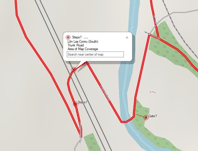
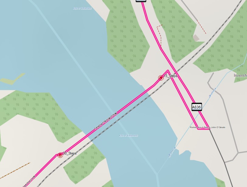
- Steps are shown if there are 2 or more steps - arbitary decision by me - I can generally manage a kerb, which is step_count=1, but maybe not anything more than that - the number of steps are shown on the map and I can then decide whether to try or not. (12th January 2024)
- Any barrier tagged as either access=private or access=customers are not shown on this map. (Testing 12th January 2024)
- Cycle barriers will appear if either their width of opening or any other dimension makes it possible I won’t fit through with my trike widest trike, which is 101cm wide. (TBD)
- Any barriers that do not have size tags, and could therefor be a problem - there are a great many of these!
- Relief map shading on Garmin Basecamp & some devices.
Trike Map - can you use it? There are so many barriers shown on the map, with the majority of them not relevant to a trike rider, that at the moment I don’t feel this map is actually useful, however, you are welcome to download it, and try it yourself. In many respects its more useful on a computer for planning a ride before you do it, as you can see any potential problems. You could always help to update OpenStreetMap so that only relevant barriers appear on the next edition.
Trike Map - planned improvements
I’m currently starting to update an open source repository on Github at https://github.com/Nick-Tallguy/mkgmap-styles-typ and am planning to use a system of processing the OSM data, and then using that processed file to produce the trike map - it’s going to take a while to develop, but I’m doing what I can whilst also getting on with life. The key to the map is the ‘barriers’ - to help produce a usable map for trike, wheelchair and mobility scooter users, please update the barriers Street complete is a very useful app on your phone for most of the updates needed.
Each map is available in 3 versions;
- barriers_xxxxx_winexe-YYYY-MM-DD.torrent for downloading the Windows executable file for installing the map for use with ‘basecamp’,
- barriers_xxxxx_gmapi-YYYY-MM-DD.torrent for downloading the file which can be used with Windows or Apple Mac, or
- barriers_xxxxx-YYYY-MM-DD for downloading the .img & .tdb file for use with QMapShack, and garmin handhelds - this is in the trike_gb_latest folder.
Read on if you would like more details, or just download them and figure it out. Once a feature is correctly tagged it disappers from the Barriers Filtered map, so it’s an easy way of seeing your progress in updating barriers.
Dimensions - terms
The following tags are in common usage, with the dimension in metres unless you specify otherwise;
width https://wiki.openstreetmap.org/wiki/Key:width
maxwidth https://wiki.openstreetmap.org/wiki/Key:maxwidth This tag relates to a legal restriction not a physical one. Be careful, as the editing programmes don’t always reflect this (Dec 2023 and JOSM v18907 suggests this tag for a gate).
maxwidth:physical https://wiki.openstreetmap.org/wiki/Key:maxwidth:physical The width of the opening.
opening, spacing, & overlap https://wiki.openstreetmap.org/wiki/Tag:barrier%3Dcycle_barrier are all used with some cycle barriers.
The Types of Barrier shown on the maps
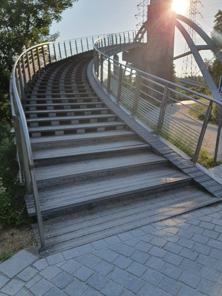
highway=steps
https://wiki.openstreetmap.org/wiki/Tag:highway%3Dsteps
I can lift my trike up 2 steps, but a flight of 20 is beyond me. If you have a 2-wheeled cycle, you will want to know if there is a ramp. My daughter with her pram may still decide to take the pram over a flight of 20 steps if her partner is with her. My mother-in-law alone on her mobility scooter will avoid any steps, but may be able to negotiate a small single step. Some users need to know if there are handrails, and/or the width of the steps. At least step_count should be tagged.
barrier=cycle_barrier
https://wiki.openstreetmap.org/wiki/Tag:barrier%3Dcycle_barrier
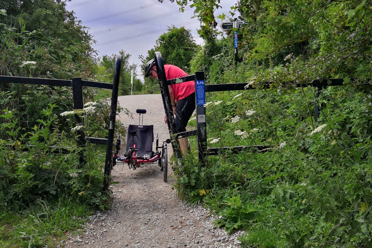
Some of these have been placed to slow cyclists down, and some have been placed to stop cycling completely. Others have been placed to try to stop motorcycles using the highway. Depending on the design of the barrier, you may need several different measurements.
barrier=bollard, and barrier=block
https://wiki.openstreetmap.org/wiki/Tag:barrier%3Dbollard & https://wiki.openstreetmap.org/wiki/Tag:barrier%3Dblock
The width of opening is important. In parts of London and other big cities, large blocks have been placed to try to prevent terrorist attacks - some also stop me on my trike!
barrier=kissing_gate
https://wiki.openstreetmap.org/wiki/Tag:barrier%3Dkissing_gate
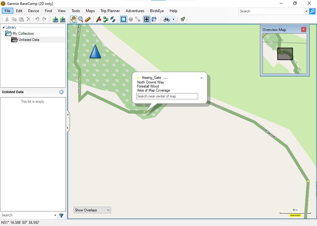
The tags in use for this feature need enhancing - although you can measure the opening, you really need to know the depth available. Some have been created with wheelchairs in mind, and there may be some you may be able to negotiate with a horse. Tagging should include the type of kissing_gate, and whether it is wheelchair accessible. I’ve been adding a tag for opening= as this may make a difference to some users.
barrier=stile
https://wiki.openstreetmap.org/wiki/Tag:barrier%3Dstile
Tagging should include the type of stile, any step_count, and also if there is a steadying post and/or a dog gate.
Filters used in the barriers_filtered map
This map shows only those barriers which I believe require their tags improved, using the following criteria;
- Barriers do not appear on this map if they are tagged as access=private, or access=customers,
- Steps appear unless they have a ‘step_count’ tag which is less than 2,
- Dimensions - I accept width, maxwidth, maxwidth_physical, and opening,
- Cycle barriers appear if they do not have tags describing their dimensions,
- Stile’s appear if they lack descriptive tags, and dimensions and are on a cycleable route,
- Kissing Gates appear if they are not tagged with their type, their dimensions are too small, and they are on a cycleable route
- Bollards and Blocks appear if they lack the size of the gaps (maxwidth:physical or opening).
The map features have altered over the years, and what was correct tagging 10 years ago, now may require updating. The terms used to describe the dimensions of the gap you go through on a barrier, also vary, so I’m happy to accept any of the following; width, maxwidth, maxwidth:physical, or opening.
12 Dec 2023
</! Categories were [OpenStreetMap, Garmin-Maps, Cycling] />
All mapping data is derived from OpenStreetMap, including the downloadable maps. Many thanks to OpenStreetMap contributors for their skill & dedication.
New - Cycle Map of GB
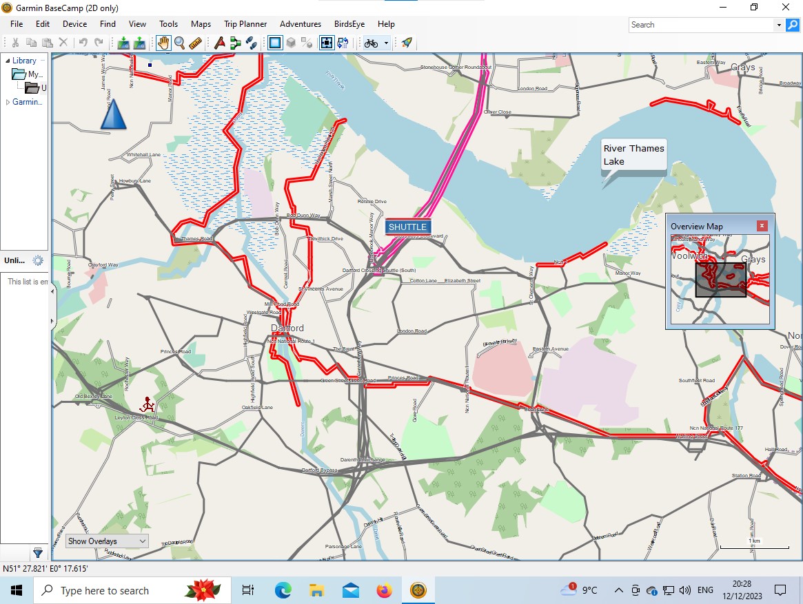
I’ve just finished creating and testing this new map with the following features:
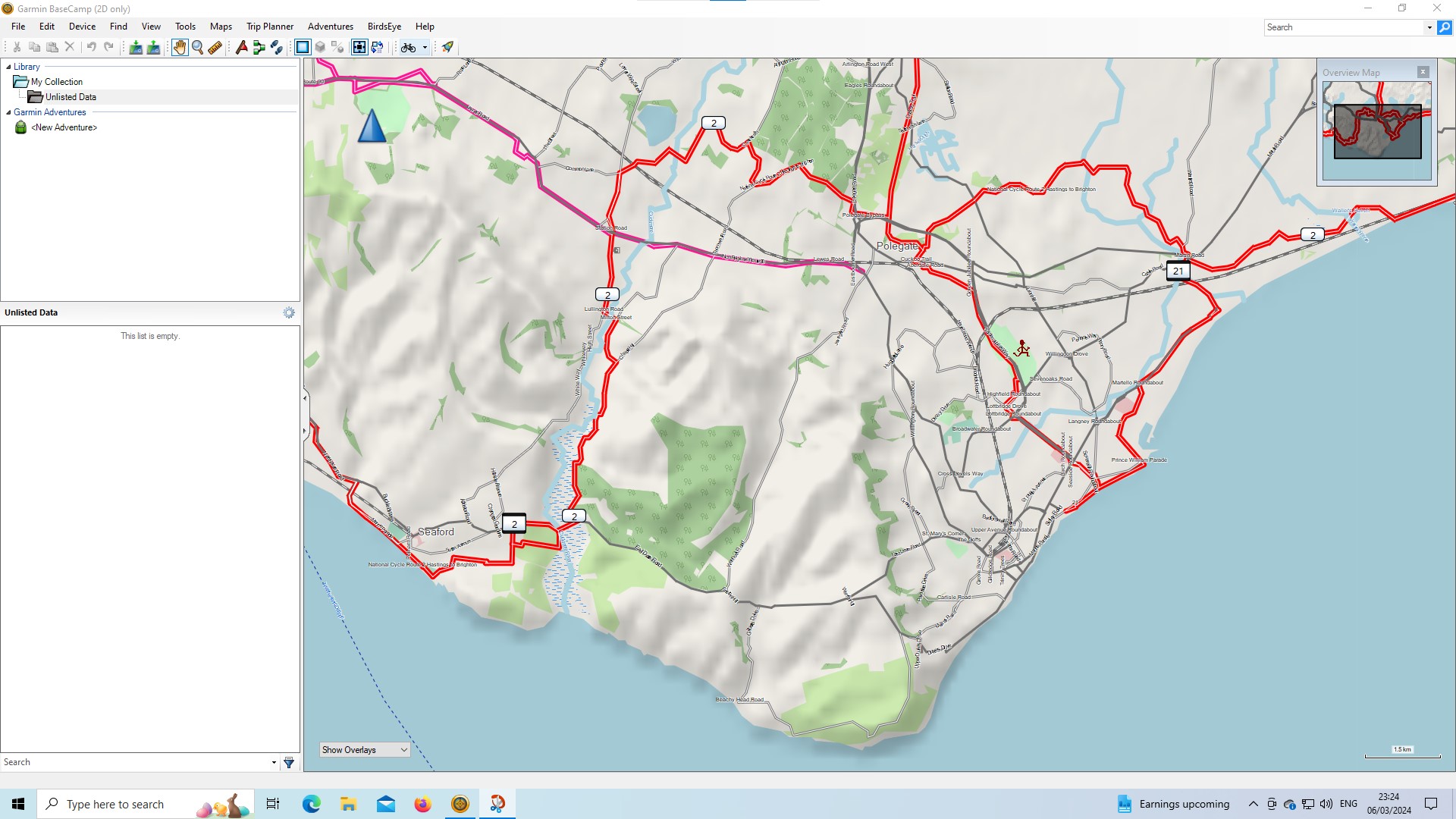
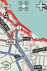
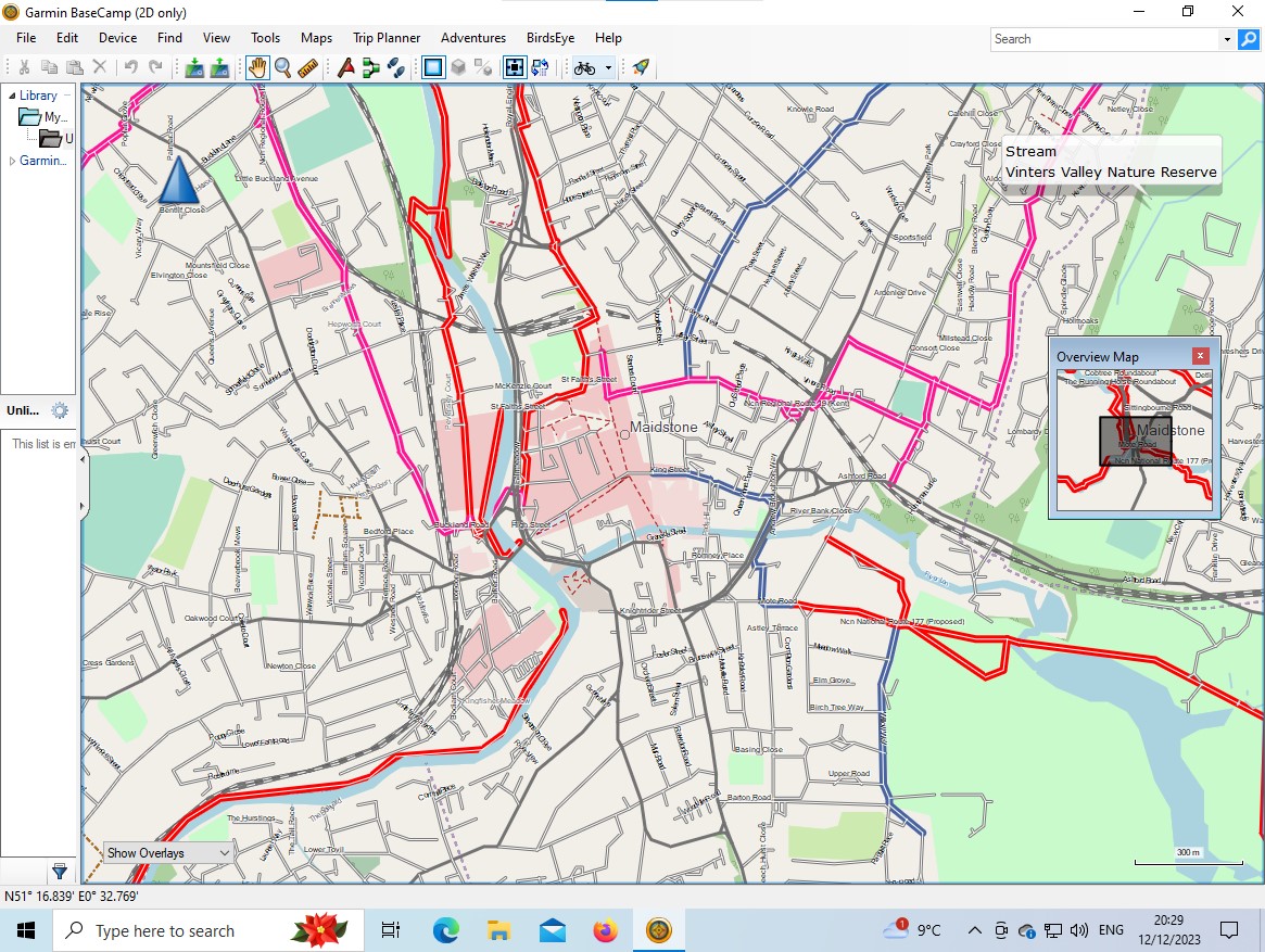
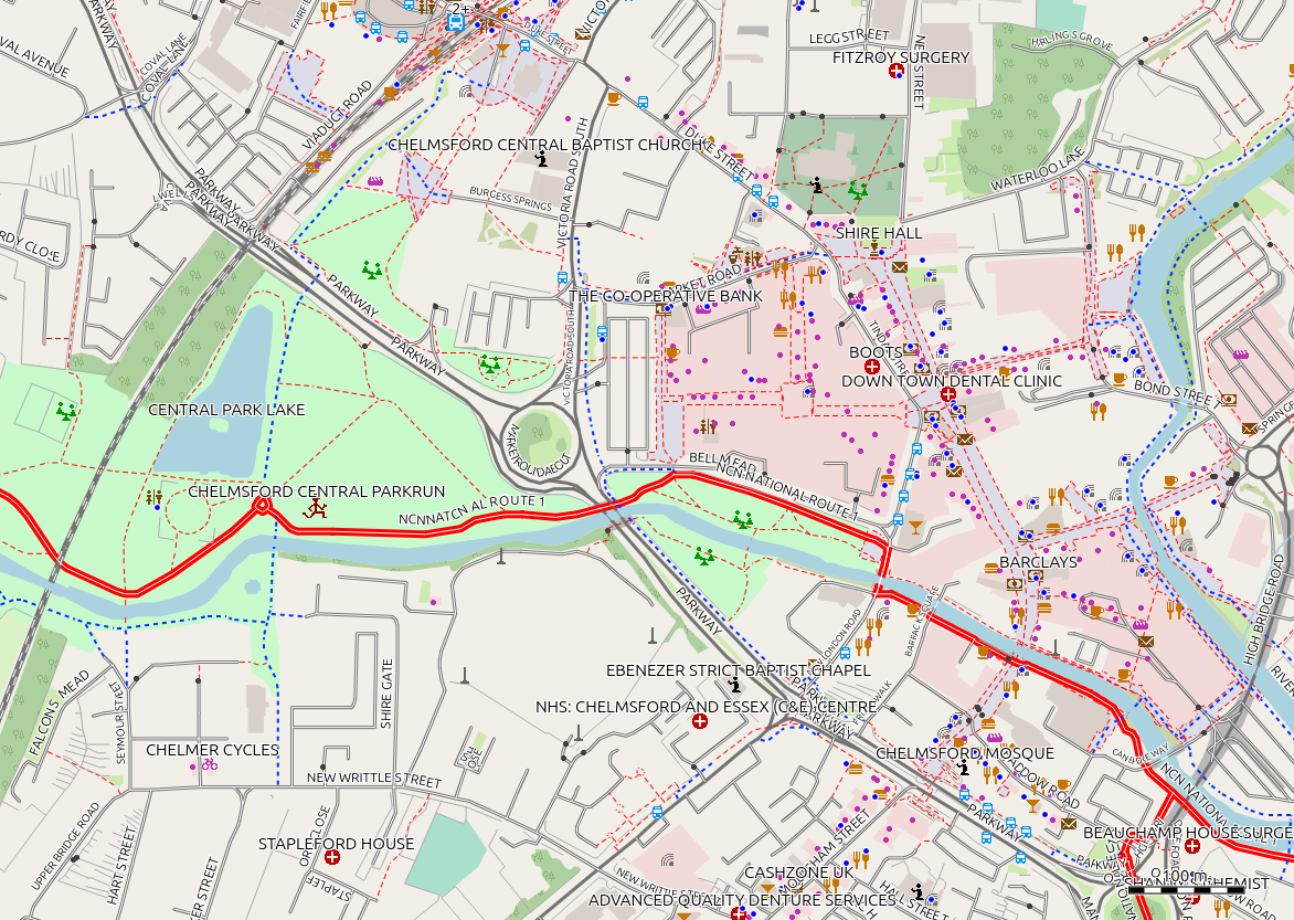
- National cycle routes are shown in bold red,
- Regional cycle routes are bold pink,
- Local cycle routes are blue,
- References for the cycle routes are displayed, often in a ‘shield’,
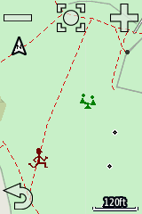
- This is a lightweight style, aimed at use on a cycle computer, and a number of changes have been made to ensure it responds quickly on a cycle computer, and that information important to a cyclist is displayed,
- Buildings are not shown,
- Gardens are not shown,
- Icons for many features not needing to be seen by a cyclist are not shown, for instance an icon for a carpet shop,
- Motorways, and other main roads that cyclists usually avoid are shown in grey,
- As cycle parking places are now so frequent, I have not shown them as in dense areas they can clutter the map so much it becomes confusing,
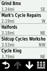
- Cycle shops, and those shops which sell cycle items used by cyclists, are shown,
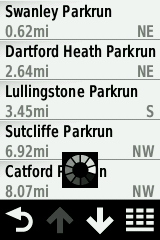
- Parkrun starting points are shown, where they have been added to OpenStreetMap,
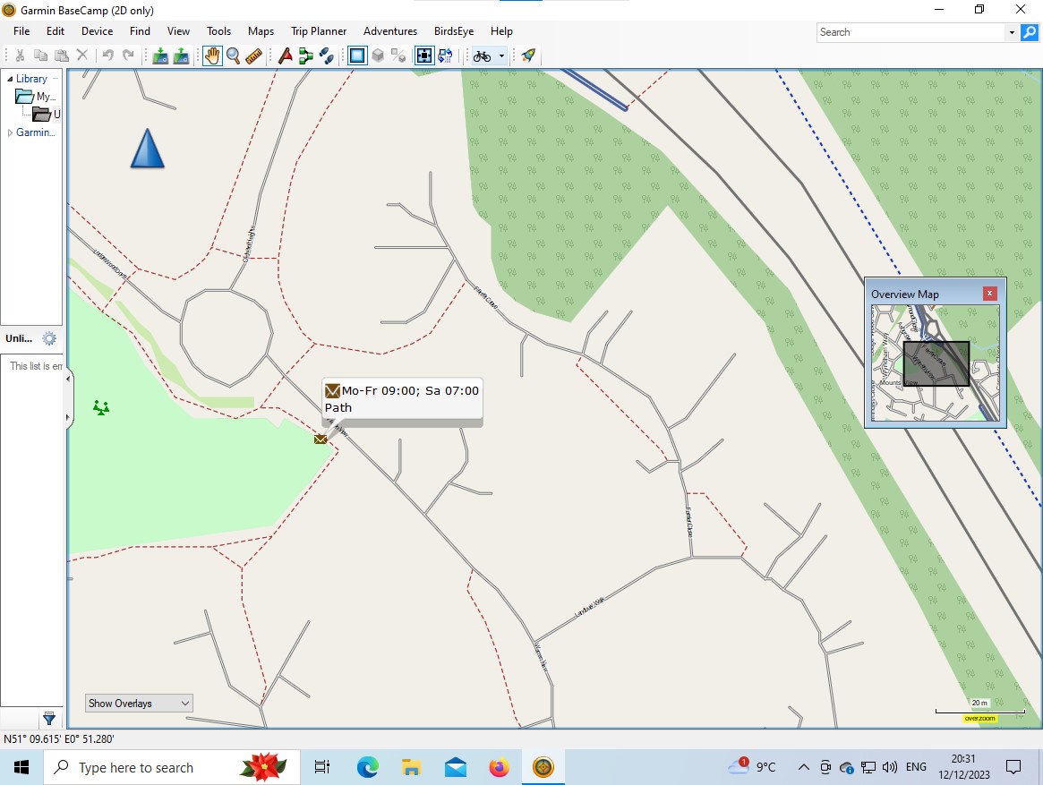
- Postboxes are shown, with their collection time, if available,
- The map is both routable, and searchable,
- Available as:
- for windows users cycle-winexe-2023-12-12.7z.torrent,
- for apple and windows users cycle-gmapi-2023-12-12.7z.torrent,
- for those using QMapShack, or who only wish to install the map on their Garmin device, cycle-2023-12-12.7z.torrent.
Available from
https://daphne-nick.uk/nextcloud/index.php/s/6cQesAz38DWRWBo
Each of the different variety (exe, gmapi, or gmapsupp & tdb) are compressed with 7-zip, but are still approaching 600mb in size, and are supplied as a torrent file, which will allow you to download the complete file.
See https://daphne-nick.uk/openstreetmap/garmin-maps/2023/10/18/garmin-map-instructions for instructions on using the files.
This map will be updated on a monthly basis whenever possible, with a new version created on the first Tuesday of the month, and posted on my site for download as soon as I have tested it, often the same day.
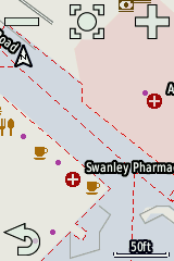
Screenshots - Garmin Edge 810
Screenshots - Garmin Basecamp
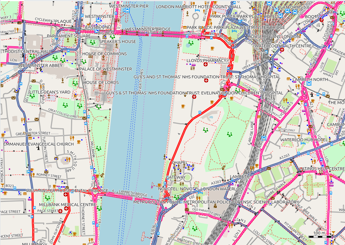
Screenshots - QMapShack
22 Nov 2023
All mapping data is derived from OpenStreetMap, including the downloadable maps. Many thanks to OpenStreetMap contributors for their skill & dedication.
Linux, Windows & Apple Mac user updates
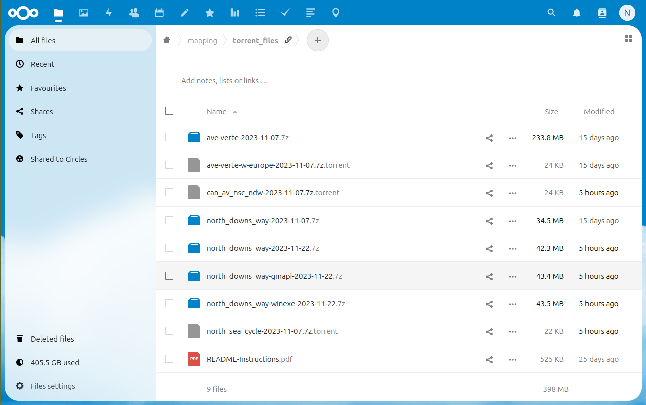
You will start to see the following changes on the download site, being gradually phased in from now, with the aim of all maps being available in these formats in the future. As usual, your starting point is the download site at
https://daphne-nick.uk/nextcloud/index.php/s/6cQesAz38DWRWBo
Linux Users
Filename is now in the form north_downs_way_2023-11-22.7z, or for those maps of over 500mb in size ave-verte-w-europe-2023-11-07.7z.torrent. Use the instructions from https://daphne-nick.uk/openstreetmap/garmin-maps/2023/10/18/garmin-map-instructions/ which explain how to deal with torrent files. When you download a file it’s polite to continue to ‘seed’ it for a while.
Microsoft Windows User Updates (.exe)
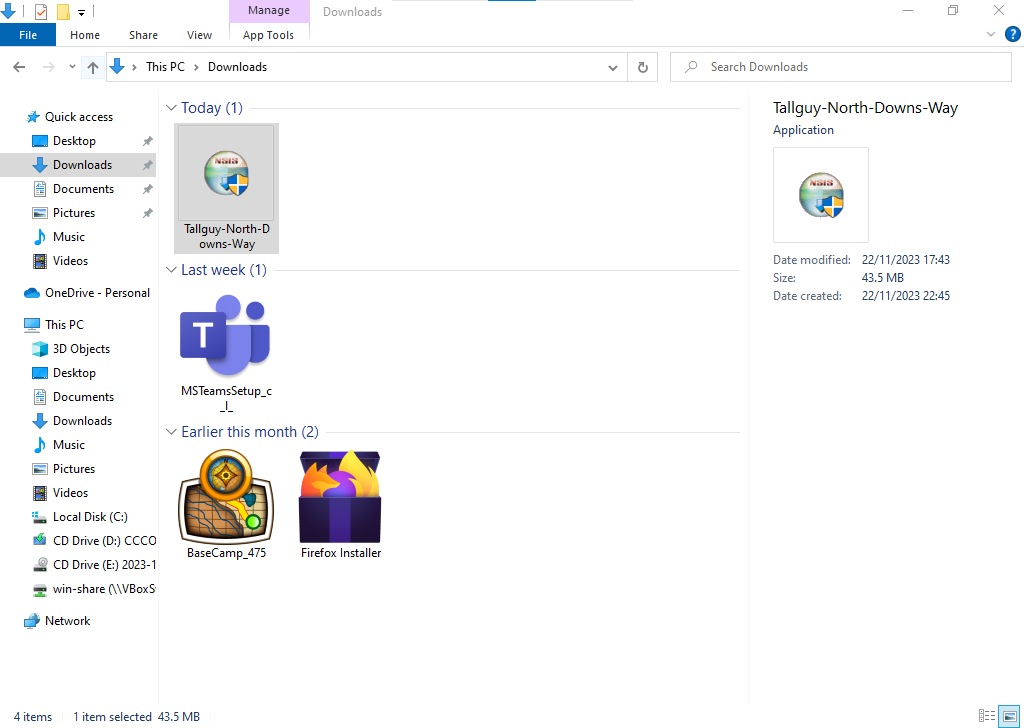
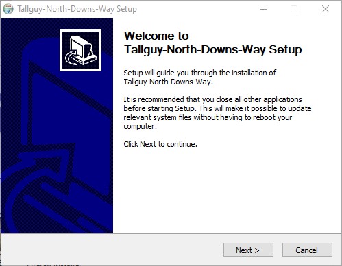
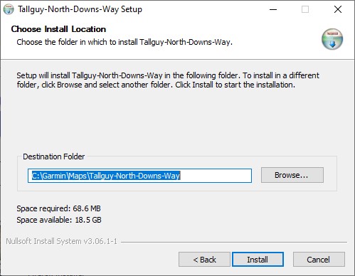
Filename is now in the form north_downs_way-winexe-2023-11-22.7z, which you can download to your Microsoft Windows computer. When you unzip it you will have a file with a name similar to Tallguy-North-Downs-Way.exe, unzip it and then run by double clicking the *.exe file which is inside. If you use both Windows & Apple Mac you may find the gmapi option below to be easier.
Apple Mac Users (.gmapi)
Filename is in the form north_downs_way-gmapi-2023-11-22.7z which you can download, unzip & then copy the complete directory tree into
{user}\AppData\Roaming\Garmin\Maps
or
\ProgramData\Garmin\Maps
and the map will be available to Garmin PC programs. This will also work for Windows users.
